
TDY: PARTLY CLOUDY AND WINDY- MID 40S
TNTE:BECOMING CLEAR- MID 20S
THURS: SUN AND CLOUDS, BREEZY – LOWER 50S
FRI: CLOUDY, SOME RAIN – 40-45
SAT: CLOUDY – WINDY- RAIN – 40S
YOUR EVENING FORECAST:
TNTE:BECOMING CLEAR- MID 20S
THURS: SUN AND CLOUDS, BREEZY – LOWER 50S
FRI: CLOUDY, SOME RAIN – 40-45
SAT: CLOUDY – WINDY- RAIN- 40S
WEATHER TRIVIA: 1942- WORST EAST COAST STORM SINCE HURRICANE OF ’38: SEVERE THUNDERSTORMS IN THE SOUTHEAST, LIGHTING DAMAGE AT BOSTON, MA., SEVERE COLD FOLLOWS WITH BLIZZARD CONDITIONS IN THE MOUNTAINS
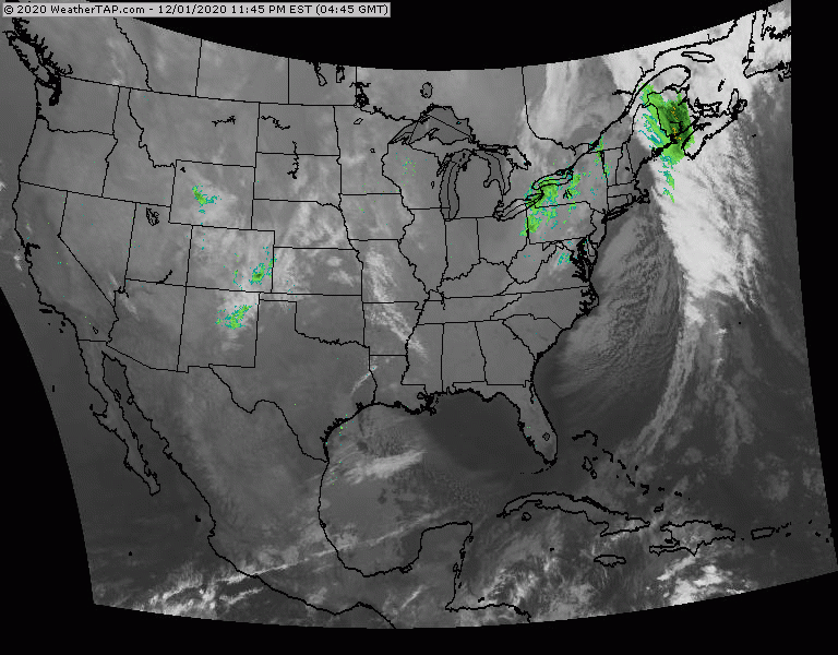
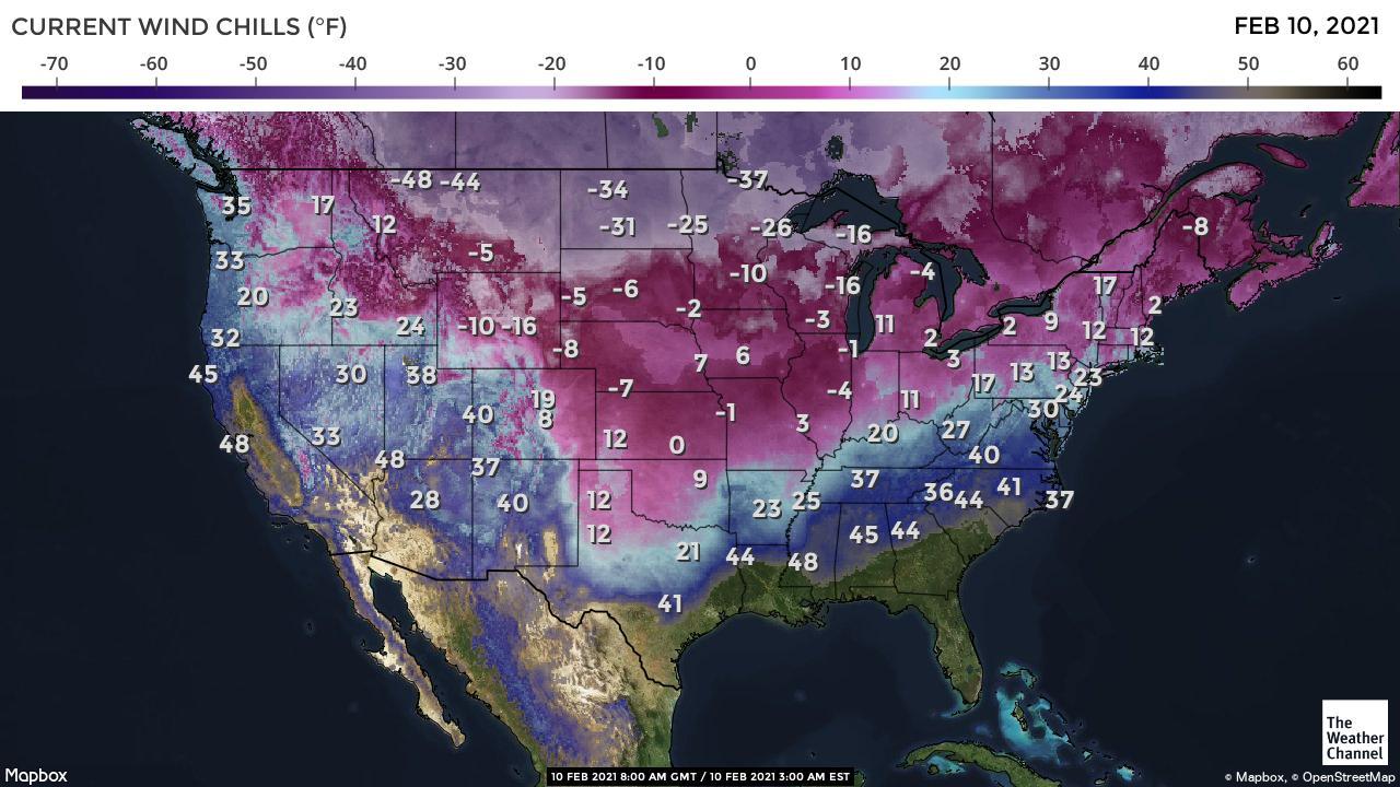
Above - satellite + radar shows lake effect snows continuing in lee of Great Lakes. New storm in So. Plains will head east then up the coast this weekend. Below - early morning wind chills....animated maps....rainfall through Monday.


WEATHERCAST: A SWEETHEART OF A HIGH OVER THE CAROLINAS WILL MAKE IT A NICE VALENTINE’S DAY WITH AT LEAST PARTLY SUNNY SKIES AND FLIRTING...

TODAY – PARTLY CLOUDY- LOWER 70S TONIGHT – CLOUDY- A SHOWER – MID 50S THURSDAY – CLOUDY- LATE SHOWERS, A THUNDERSTORM -LOWER 70S FRIDAY...

Your Robin Hood Radio Tri-State Forecast ...WINTER STORM WARNING REMAINS IN EFFECT FROM 4 PM THIS AFTERNOON TO 1 PM EST THURSDAY... * WHAT...Heavy...