
CURRENT ADVISORIES - BERKSHIRES – WINTER STORM WATCH SATURDAY AFTERNOON TO SUNDAY A.M.
TDY: TURNING CLOUDY, SOME RAIN LATE DAY OR AT NIGHT – 45-50
TNTE: PERIODS OF RAIN - 40
SAT: CLOUDY – WINDY- RAIN – LOWER 40S
SUN: WINDY- SOME RAIN A/O SNOWSHOWERS – LOWER 40S
MON: PARTLY CLOUDY- 45-50
WEATHER TRIVIA: 1898- 2ND SEVERE COASTAL STORM IN 10 DAYS
83 MPH WINDS @ ATLANTIC CITY, N.J.

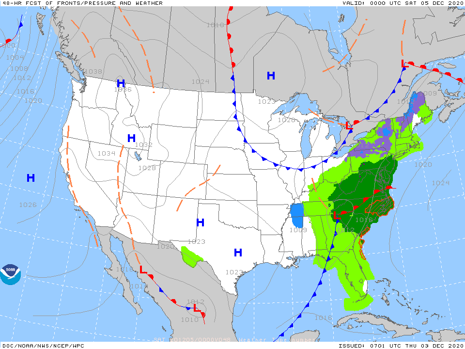
Above..satellite + radar.....notice rain and clouds in South pushing north....notice clouds over Great Lakes pushing south .....these 2 jet stream will likely merge forcing southern storm to intensify off Mid Atlantic Coast Saturday. HEAVY RAIN with this system from Mid Altnatic to New England...which could easily end as wet snow across the interior Saturday evening. Windy and colder behind it. Weather elsewhere and through next week....quiet. Below - animated maps - rainfall through Tuesday....and snapshot weather for Friday. Be safe.


A look at the weekend weather and the Monday eclipse Share this:TwitterFacebookEmailLike this:Like Loading...
…HEAT ADVISORY REMAINS IN EFFECT FROM NOON TO 9 PM EDT TUESDAY… * Location…The Lake George Saratoga Region, Mohawk Valley, Schoharie Valley, Helderbergs, Greater...
WEATHERCAST: A LARGE STORM EXTENDS FROM THE GREAT LAKES TO THE NORTHEAST AND WILL PUSH NORTH TODAY, SO RAIN AND WIND EASES FROM SOUTH...
