
YOUR FORECAST:
TDY: CLOUDY – SCATTERED SHOWERS – MID 70S
TNTE: PERIODS OF RAIN – MID 60S
SAT: CONSIDERABLY CLOUDY= HUMID – SHOWERS AND THUNDERSTORMS –MID 70S
SUN: PARTLY SUNNY – 85-90 MON: HAZY – HOT- HUMID- MAYBE A THUNDERSTORM - 90
WEATHER TRIVIA: 1918- NEW YORK CITY HAS WARMEST DAY AND NIGHT: 102 DAY – 82 AT NIGHT.
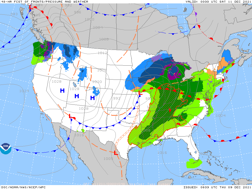
Wet weather becomes more widespread for the East. Showers and storms from Rockies to Plains. Tropics - quiet. Below - animated maps - severe weather for today - rainfall through Monday


Below - snapshot weather for Friday. Be safe.

Your Robin Hood Radio Tri-State Forecast TODAY– PARTLY CLOUDY- WINDY-– MID 70S TONIGHT – CLEAR – MID 40S WEDNESDAY – SUNNY – BREEZY –...

Lots to do this weekend! Pine Plains, Salisbury, Norfolk Fall Festivals…Sharon Audubon Walk, Brew-Ski-Fest, Dasi Hill Day of fun, and more…wow what a weekend…follow...

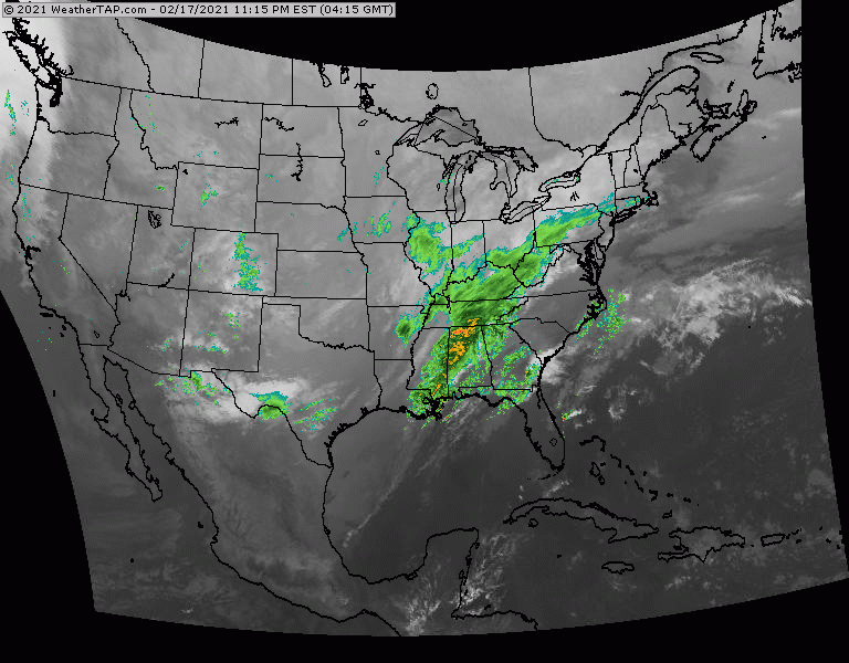
Above- satellite picture shows storms over the Great Lakes….Northern Rockies….otherwise quiet. Below – snow forecast through 48 hrs….animated maps thru Wednesday – rainfall into...