
TDY: SUNNY- 65-70
TNTE: CLEAR – 45-50
SAT:SUN MIXING WITH CLOUDS – 75-80
SUN: CLOUDY – 60-65
MON: CLOUDY- COOL – PERIODS
OF RAIN – MID 50S
WEATHER TRIVIA:1903 – NEW YORK CITY’S HEAVIEST RAIN: 11” @ CENTRAL PARK IN 24 HOURS,OVER 15” IN PARTS OF NEW JERSEY.
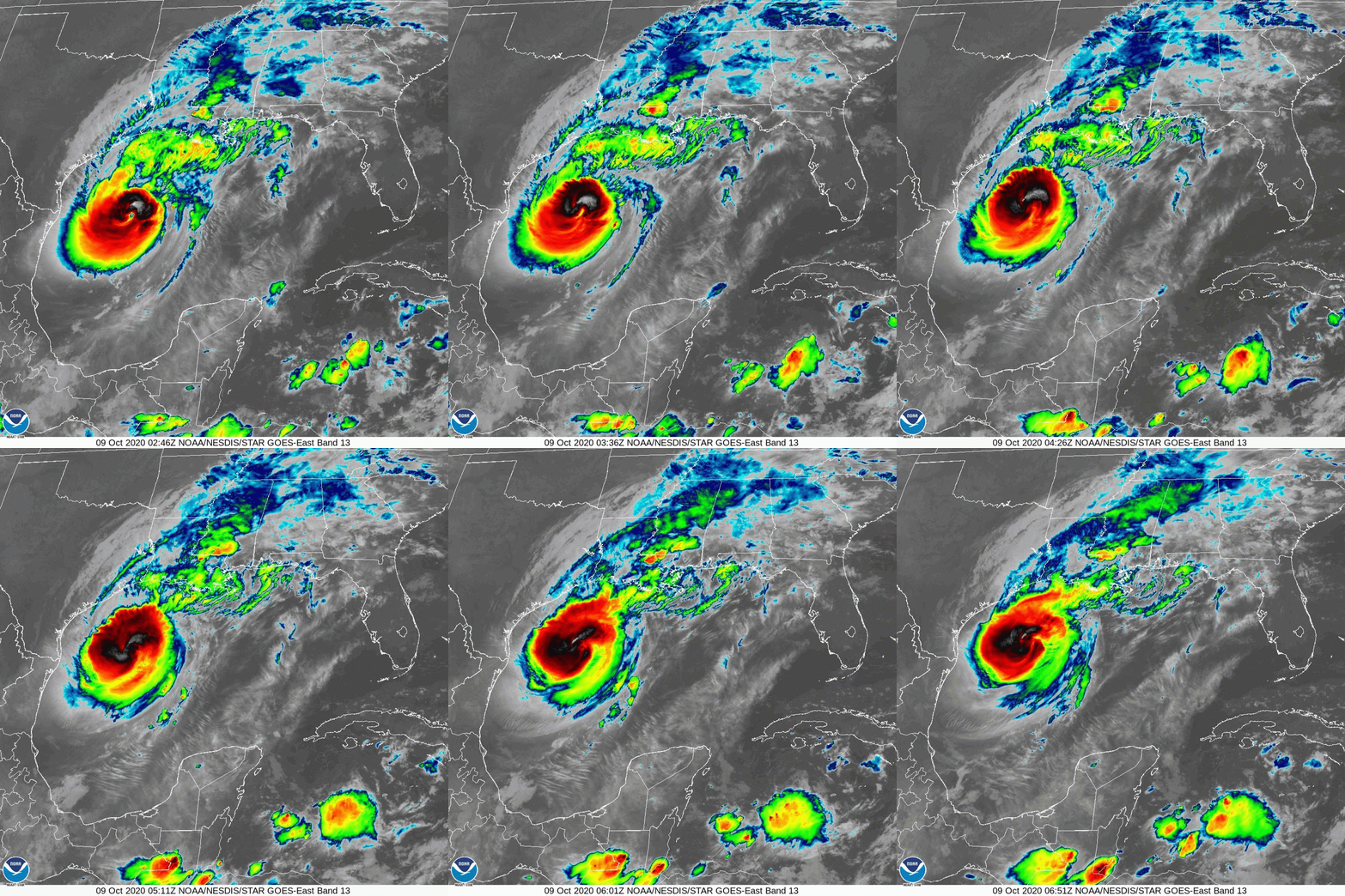
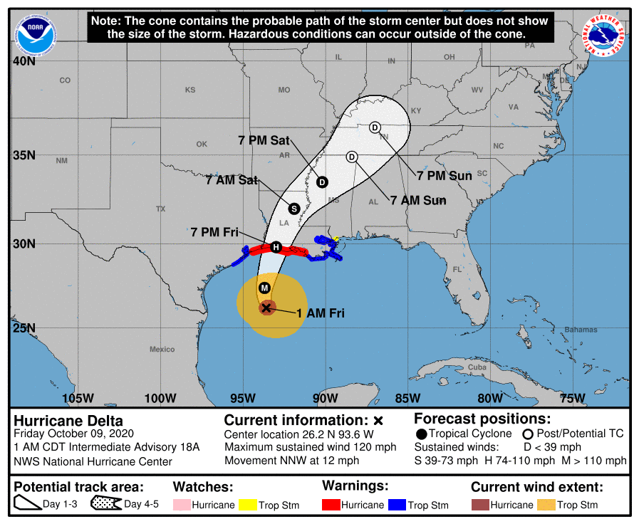
Satellite above shows major hurricane Delta with 115-120 mph winds moving
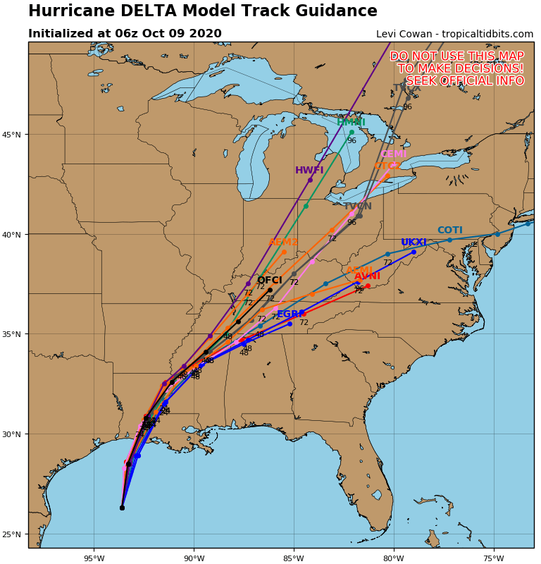
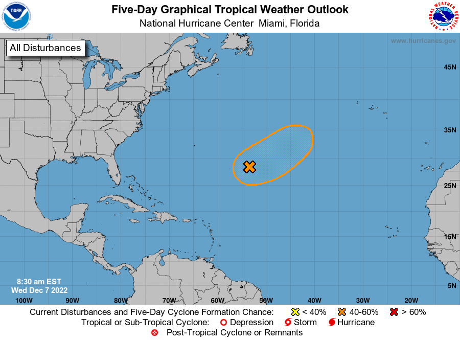
toward Louisiana. It will weaken over Kentucky and spread rain all the way to New England by Monday. Below - Hurricane Center track, track of models, and Atlantic basin map showing next system off Africa.

Your Robin Hood Radio Tri-State Forecast TODAY: SUNNY & TURNING BREEZY – NEAR 60 TONIGHT: CLEAR, LIGHTER WINDS – 30-35 TUESDAY: SUNNY & PLEASANT...
Your Robin Hood Radio Tri-State Forecast TODAY – CLOUDS, A SHOWER, SOME SUN – 75-80 TONIGHT – CLOUDY- 60 SATURDAY – PARTLY SUNNY –...

WEATHERCAST: A COLD FRONT IN CENTRAL N.Y. AND PA. WILL REACH THE COAST BY EVENING. SUN AND CLOUDS WILL GIVE WAY TO SHOWERS AND...