
YOUR DAYTIME FORECAST:
TDY: BLUSTERY CLOUDS AND WIND, PASSING RAIN OR SNOWSHOWERS – MID 40S
TNTE: CLEAR- COLD – MID 20S
WED: SUNNY- BREEZY – COLD – 40
THURS: SUNNY- MID 40S
FRI: PARTLY CLOUDY- MILD – 55-60
YOUR EVENING FORECAST:
TNTE: CLEAR- COLD – MID 20S
WED: SUNNY- BREEZY – COLD – 40
THURS: SUNNY- MID 40S
FRI: PARTLY CLOUDY- MILD – 55-60
WEATHER TRIVIA: 1894- OKLAHOMA CITY DROPS TO A RECORD 9 BELOW.
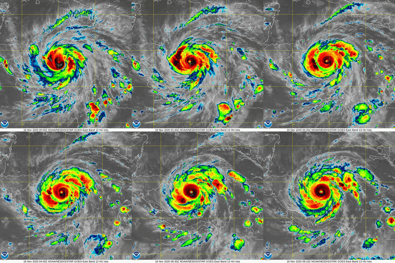
Cat 4 hurricane Iota with 145 mph winds will slam into Central America tonight....the 2nd major hurricane there in 2 weeks. After that it will emerge into the Pacific and probably be given a new name.

YOUR FORECAST: TDY: CLOUDS & SUN – LOWER 30S TNTE: CLEAR – COLD – MID TEENS FRI: SUN WITH INCREASING CLOUDS – MID 30S...
YOUR FORECAST: TDY:SUN AND CLOUDS – MID 60S TNTE: CLOUDY- MID 40S WED:MAINLY CLOUDY- SHOWERS – 55-60 THURS: CLOUDY – SHOWERS – 55-60 FRI:...
WEATHERCAST: GOOD WEATHER IS WAITING IN THE WINGS. FIRST…THE CLOUDY DAMP WEATHER WILL PUSH ON OUT BY TONIGHT. THERE WILL BE A CHILL WIND...