
YOUR FORECAST:
TDY: PARTLY SUNNY AND HUMID – 90
TNTE:TURNING CLOUDY- SHOWERS DEVELOPING – 70-75
TUES:RAIN, WIND AND THUNDERSTORMS INCREASING – 75-80WED: PARTLY CLOUDY- HUMID – SHOWERS AND THUNDERSTORMS – MID 80S
THURS: PARTLY CLOUDY- A SHOWER OR THUNDERSTORM - MID 80S
WEATHER TRIVIA:1970 – HURRICANE CELIA HITS THE TEXAS COAST: CORPUS CHRISTIE MEASURES 161 MPH WINDS….11 DEATHS ……454 MILLION IN DAMAGES.
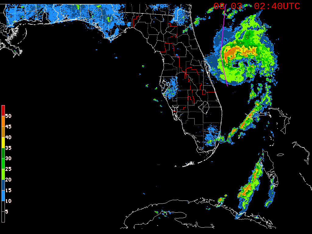
Isaias is off Florida with 70 mph winds and will likely become a hurricane before hitting the Carolinas tonight. After that it will move across Delmarva to New York City Tuesday into Tuesday evening and then speed across New England by Wednesday morning. Below - track by Hurricane Center....tracks by various models.......rainfall through Friday.


Below - severe weather threat today + animated maps


Below - snapshot weather for Tuesday + satellite & radar combo.
Be safe !!!!


Your Robin Hood Radio Tri-State Forecast CURRENT ADVISORIES: WINTER STORM WARNING UNTIL MIDNIGHT TONIGHT- CONN UNTIL 10PM FOR BERKSHIRES….UNTIL 7PM FOR CATSKILLS TODAY –...

Your Robin Hood Radio Tri-State Forecast TDY: SUNNY- MID 60S TNTE: CLEAR- 45-50 FRI: PARTLY SUNNY – INDIAN SUMMERLIKE - 70 SAT AND SUN:...

Your Robin Hood Radio Tri-State Forecast TODAY- CONSIDERABLY CLOUDY- MID 70S TONIGHT – CLOUDY- MAYBE A SHOWER – LOWER 60S SATURDAY – PARTLY CLOUDY-...