
YOUR FORECAST:
TDY: SUNNY..HOT – MORE HUMID – 90
TNTE: CLOUDY- HUMID – A SHOWER AND THUNDERSTORM – 70-75
SAT: CLOUDY- SHOWERS AND THUNDERSTORMS – MID 80S
SUNDAY: EARLY SHOWERS OTHERWISE SUN AND CLOUDS, LESS HUMID – LOWER 80S
MONDAY: PARTLY SUNNY – LESS HUMID – LOWER 80S
WEATHER TRIVIA:1916 – MOBILE, ALABAMA – EARLY SEASON HURRICANE – WIND 82 MPH…TIDES 11 FT ABOVE NORMAL.

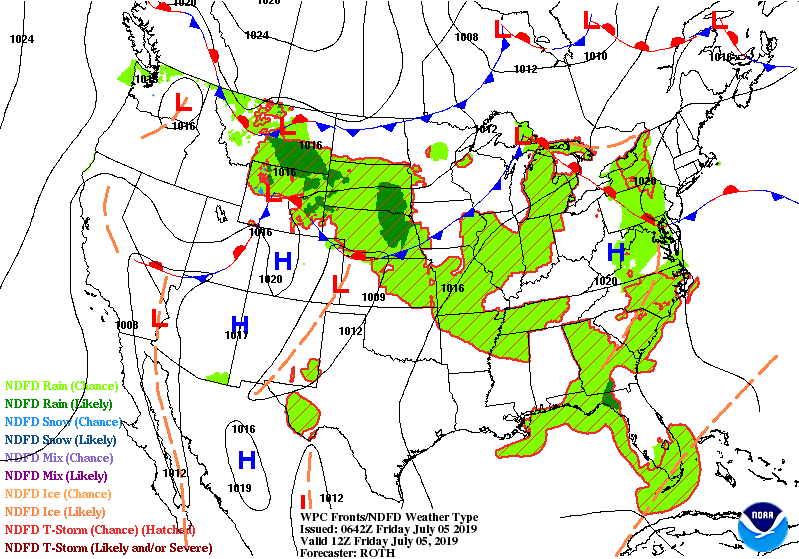
Showers and thunderstorms Northern Plains....Great Lakes...Southeast. Storms in Plains head east to affect Northeast and Mid Atlantic Saturday and then the SOutheast next week. Below - today's threat of severe weather in dark green and yellow.

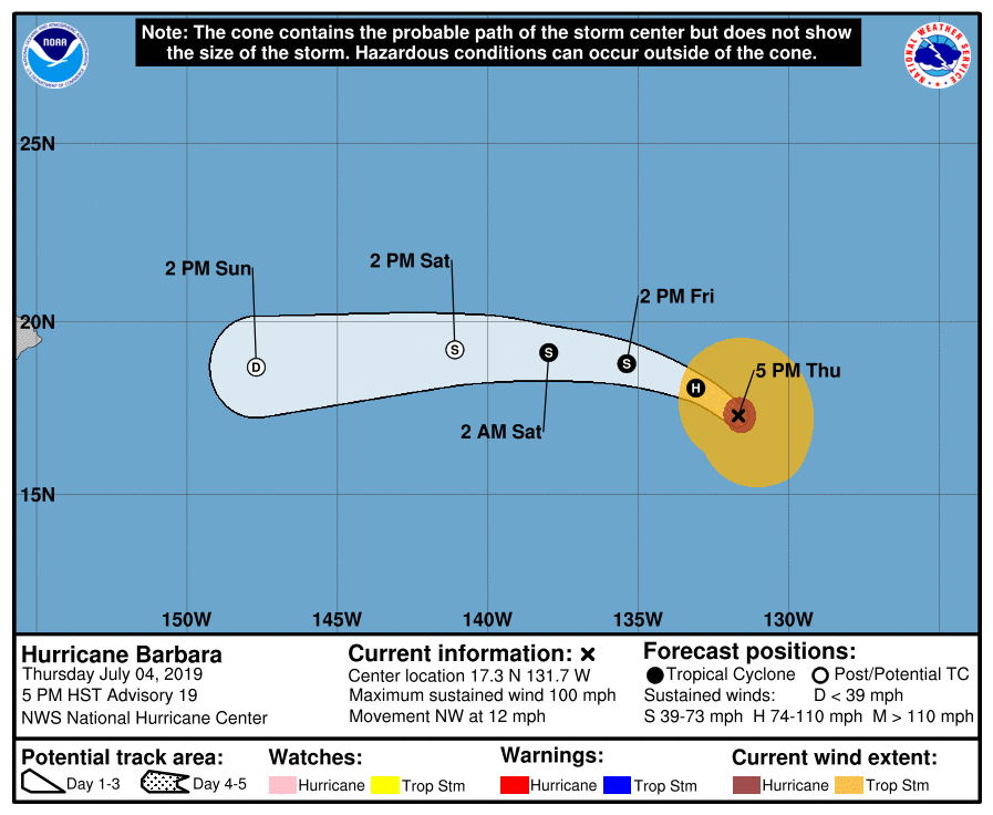
Below - track of Hurricane Barbara. She has 100 mph winds but is likely to weaken before approaching Hawaii early next week. Following that...animated maps for the next 2 days.
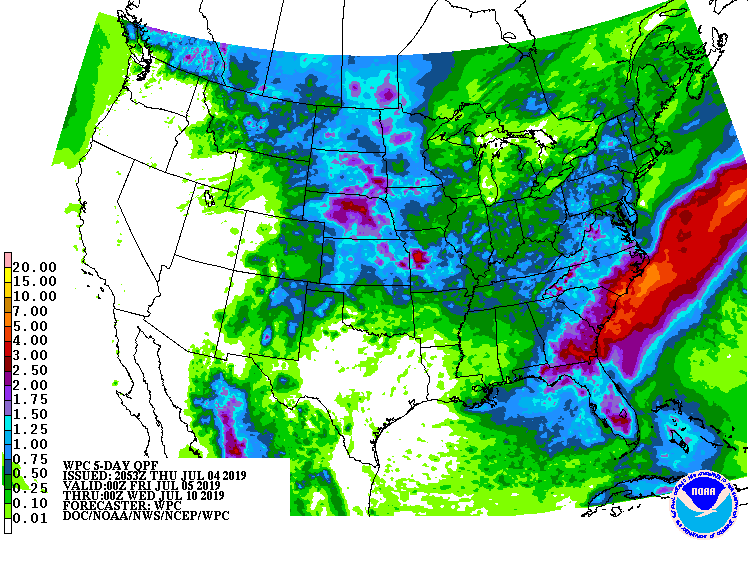
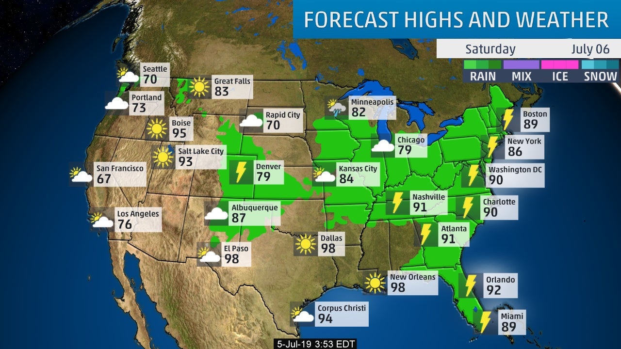
Following...rain predictions into mid next week. Heaviest expected over the southeast with a stalled front which could mean trouble down the road. After that...a snapshot of weather for your Saturday. Have a nice weekend and be safe.

YOUR FORECAST: TDY & WED: PARTLY CLOUDY – HOT – STICKY- SCATTERED SHOWERS AND THUNDERSTORMS – LOWER 90S TNTE:CLOUDY- A SHOWER OR THUNDERSTORM -...
YOUR FORECAST: TODAY: MOSTLY CLOUDY WITH SHOWERS AND VERY WINDY – 60-65 – 50 BY EVENING TNTE: CLEAR- BRISK- 35-40 TUES: MOSTLY SUNNY BUT...
A widespread light snowfall is expected across the region tonight into Thursday morning. This will likely lead to slippery travel conditions during much of...