
YOUR FORECAST:
TDY: PARTLY SUNNY – HOT – 90
TNTE: PARTLY CLOUDY- 65-70
SAT: HAZY – HUMID – CHANCE OF A GUSTY THUNDERSTORM – MID 80S
SUN: SOME SUN, BREEZY – SHOWERS – 80
MON: SUNNY- MID 80S
WEATHER TRIVIA:1924 – MASSIVE TORNADO HIT SANDUSKY OHIO THEN ACROSS LAKE ERIE TO SMASH LORAIN: 85 KILLED - $12 MILLION IN DAMAGES.
Radar + satellite show areas of storms in Northwest...Dakotas...N.Mexico...Ohio Valley and Southeast. Typical summer pattern through weekend. Below- risk of severe weather today in dark green and yellow.
Following - animated maps - rainfall into Monday.
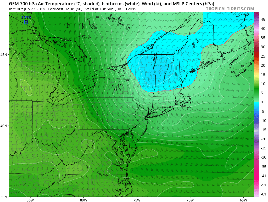
below- map showing upper air temps and wind on Sunday. Blue denotes cold air aloft and this will be responsible for clouds and showers and
possible thunderstorms over New England...some of which could drift south to affect coastal areas.
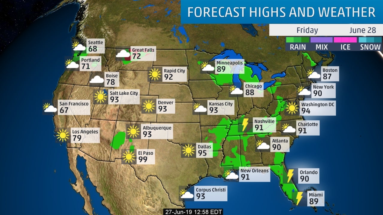
Lastly - snapshot weather for Friday. Be safe.

Your Robin Hood Radio Tri-State Forecast TDY: PARTLY SUNNY – A LATE DAY SHOWER OR THUNDERSTORM – 75-80 TNTE: CLOUDY- SHOWERS, A THUNDERSTORM –...
YOUR FORECAST: TODAY: SUN MIXING WITH CLOUDS – MID 60S TNTE: CLOUDY- SOME RAIN AND DRIZZLE – MID 40S TUES: SOME RAIN OR DRIZZLE...

Your Robin Hood Radio Tri-State Forecast TODAY – SUN & CLOUDY PERIODS – 60 TONIGHT – CLEAR – UPPER 30S SATURDAY – SUN –...