

YOUR FORECAST:
TDY: HAZY – HUMID – CHANCE OF A THUNDERSTORM – 90
TNTE:A SHOWER OR THUNDERSTORM- 65-70
TUES & WED: PARTLY CLOUDY – HOT – STICKY- SCATTERED SHOWERS AND THUNDERSTORMS – LOWER 90S
THURS: WARM AND HUMID WITH SHOWERS AND STORMS – MID 80S
WEATHER TRIVIA:1972 – ONE OF THE MOST COSTLY U.S. WEATHER DISASTERS: EX-HURRICANE AGNES DROPS 12” OF RAIN OVER PENNSYLVANIA & NEW YORK: 122 KILLED, 2.1 BILLION DOLLARS IN DAMAGE.

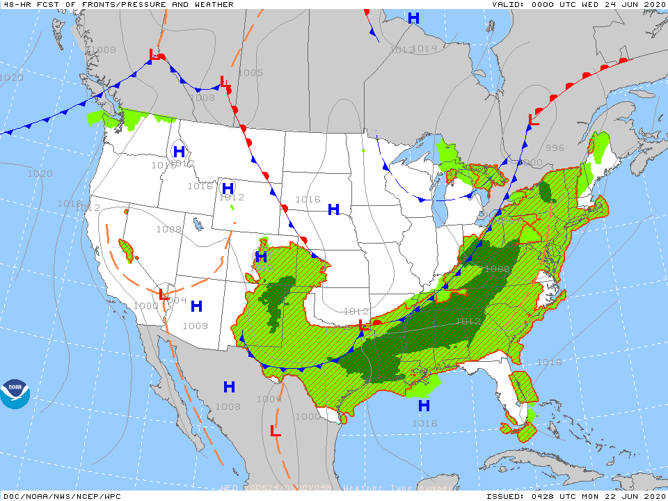
Above- satellite + radar shows a tropical like disturbance south of Cape Cod. It will slowly weaken. Thunderstorms from So. Plains to Ohio Valley moving ever so slowly east during the week. Fair and dry West. Below - tropical map.

Below - today's risk of severe is dark green and yellow....animated maps...rainfall through Friday.


Snapshot weather for Tuesday. Be safe.

Your Robin Hood Radio Tri-State Forecast TODAY: PLENTY OF SUN, UPPER 70S TONIGHT: INCREASING CLOUDS, NEAR 50 TUESDAY: CLOUDY SKIES WITH SCATTERED SHOWERS, LOW...

WEATHERCAST: AS HIGH PRESSURE SLIDES EAST FROM THE MIDWEST- PARTLY SUNNY SKIES TODAY BRING TEMPS INTO THE LOWER 80S…..THEN CLEAR IN THE 50S TONIGHT....
YOUR FORECAST: TODAY: VARIABLY CLOUDY AND WINDY – LOWER 60S TNTE: BECOMING CLEAR AND CHILLY – 35-40 TUES: SUNNY TO PARTLY CLOUDY- MID 60S...