WINTER STORM WARNING IN EFFECT FROM 10 AM TUESDAY TO 6 AM EST WEDNESDAY * WHAT...Heavy mixed precipitation expected. Total snow and sleet accumulations of 4 to 6 inches up to 6 to 8 inches expected in some areas. Ice accumulations of a tenth to quarter of an inch are expected. * WHERE...In Connecticut, Litchfield County. In New York, Dutchess County. * WHEN...From 10 AM Tuesday to 6 AM EST Wednesday. * ADDITIONAL DETAILS...Travel will be very difficult to dangerous for the Tuesday evening commute. Snow will come down heavy at times in the afternoon, mixing with and changing to sleet late in the day, with a changeover to freezing rain at night. Snow rates around an inch per hour are possible Tuesday afternoon.


Today: Mostly sunny, with a high near 65. Southwest wind 5 to 10 mph. Tonight: Mostly clear, with a low around 38. West wind...
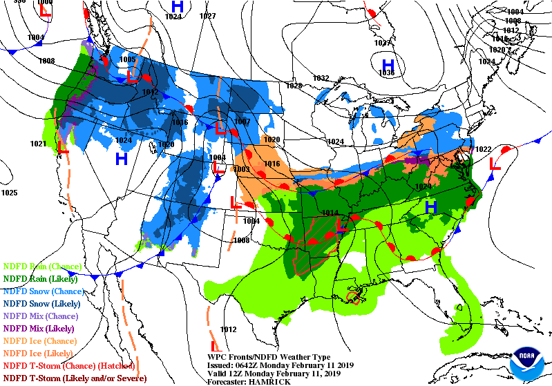
Wet Weather Shifts To Central U.S. ABove, satellite + radar shows rain moving into Great Lakes and that will be just the start of...

TODAY – SUNNY WITH DEVELOPING CLOUDS - MID 40S TONIGHT – CLOUDY- MID 30S THURSDAY – CLOUDY- SHOWERS DEVELOPING – 55-60 FRIDAY – SHOWERS...