
YOUR FORECAST:
TDY:SUN AND CLOUDS – MID 60S
TNTE: CLOUDY- MID 40S
WED:MAINLY CLOUDY- SHOWERS – 55-60
THURS: CLOUDY – SHOWERS – 55-60
FRI: VARIABLY CLOUDY, WINDY- SOME SHOWERS – MID 50S…
WEATHER TRIVIA:1857- LATE SEASON FREEZE – SNOW FELL IN EVERY STATE: HOUSTON, TX = 21F.

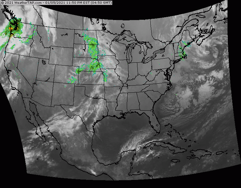
Above...satellite + radar shows a cluster of rain and storms moving through the Mid Atlantic. Moisture in Texas and The Plains will bring more rain and storms to East Thursday. Storms off California will be a big weather maker this Easter Weekend will severe weather in Southern Plains and heavy snows Rockies to Plains...reaching East Coast on Monday. Below - today's risk of severe weather - dark greens- yellow- brown.....animated maps....and rainfall through Sunday.


Below- snapshot weather for Thursday.
Stay IN....and DO NOT CONGREGATE.....STAY 6FT OR MORE AWAY FROM EVERYONE.


Your Robin Hood Radio Tri-State Forecast YOUR FORECAST:TDY: PARTLY CLOUDY - MID 80S TNTE: CLOUDY- SHOWERS LATE – MID 60S FRI: CLOUDY – SCATTERED...
Satellite & Radar show some rain in Texas…and Pacific Northwest. These areas will combine and move east but not before bringing severe weather tomorrow...

TODAY– CLOUDY- WITH SHOWERS – 55-60 TONIGHT – SHOWERS AROUND – 40-45 WEDNESDAY – SCATTERED SHOWERS – SOME SUN AND WINDY – MID 50S...