1/16/2019
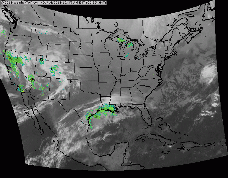
Satellite + radar shows disturbance # 1 moving out of Rockies and will bring light snow to Northeast by Friday. Storm # 2 just off West Coast should be a blockbuster as it moves across the nation this weekend.
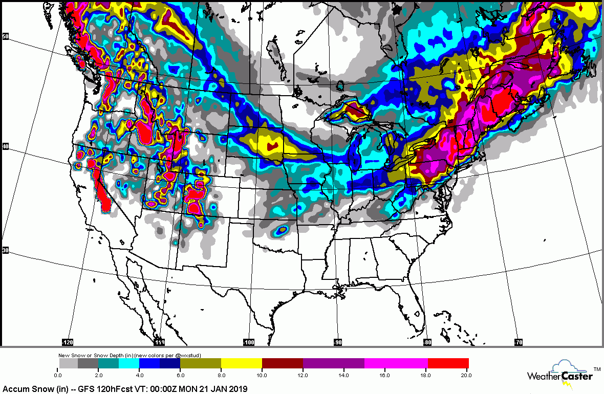
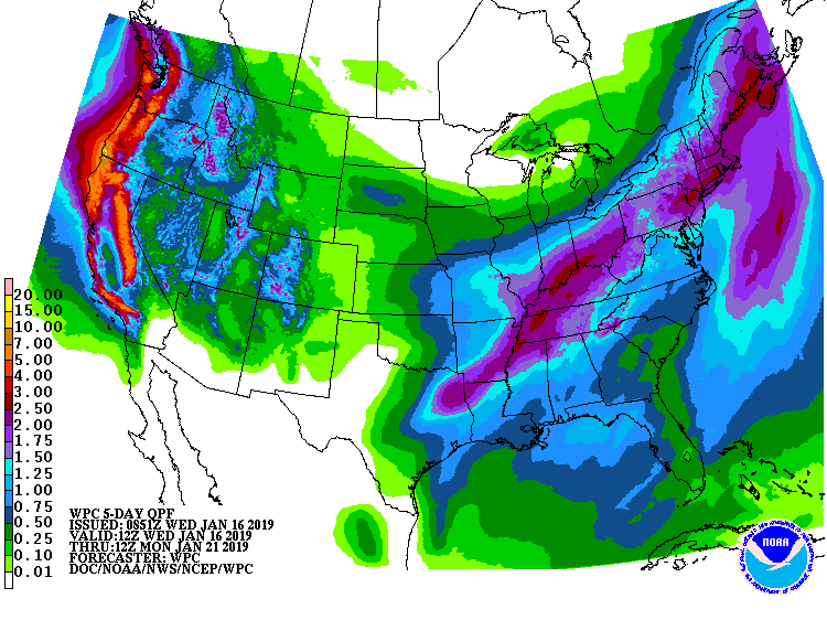
Chicago could see over 6" of snow....but from the No. Appalachians to New England, they will be measuring in feet. Big cities along I-95 from Boston to Philly will see everything, including flash-freezing, which will make travel hazardous on Sunday. Below: expected snowfall and rainfall through Monday.

URGENT - WINTER WEATHER MESSAGE National Weather Service Albany NY 333 AM EST Wed Feb 23 2022 Northern Litchfield-Southern Litchfield-Northern Berkshire- Southern Berkshire-Western Greene-Eastern...

Your Robin Hood Radio Tri-State Forecast CURRENT ADVISORIES: HEAT ADVISORY UNTIL 8PM TUESDAY TODAY – SUN AND CLOUDS, HUMID – GUSTY THUNDERSTORMS – LOWER...

Your Robin Hood Radio Tri-State Forecast TDY: BECOMING PARTLY SUNNY – 65-70 TNTE:PARTLY CLOUDY -50 TUES: CONSIDERABLY CLOUDY, MAYBE A SHOWER – 65-70 WED:...