YOUR FORECAST:
TDY: SUNNY- VERY WARM – MODERATELY HUMID – 90
TNTE: PARTLY CLOUDY – MID 60S
4TH OF JULY: HAZY, VERY WARM & HUMID, 90
FRI: PARTLY CLOUDY- LATE THUNDERSTORMS – 85-90
SAT: CLOUDY- SHOWERS AND THUNDERSTORMS – MID 80S
WEATHER TRIVIA:
1966- HOTTEST DAY EVER: PHILADELPHIA, PA – 104F, N.Y.C AND HARRISBURG, PA = 107F


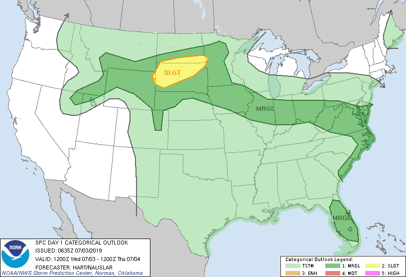
Satellite + radar shows scattered storms from NW to Dakotas.....Ohio Valley...So.Plains.....Gulf Coast. Pattern not expected to change much. Storms in Dakotas will move across the Northeast Saturday. Below..threat of severe weather today - dark green and yellow.
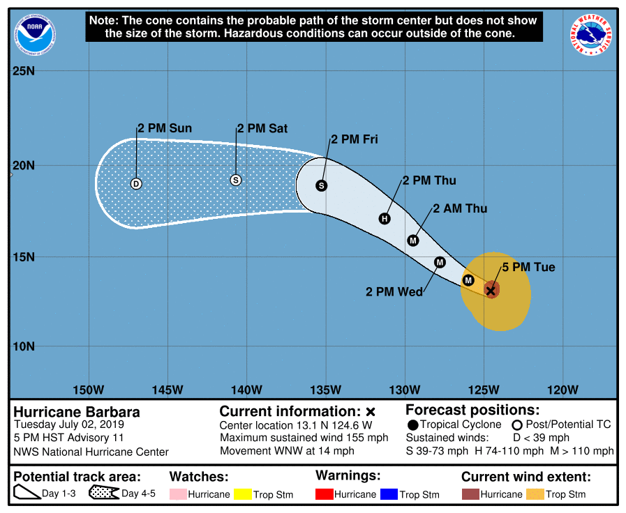
Below- satellite picture and track of Hurricane Barbara in Pacific. Right now 150 mph winds but expected to weaken as she heads for Hawaii next week.

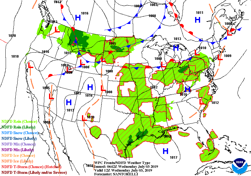
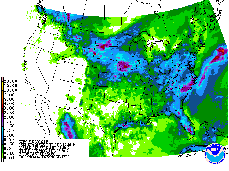
Below - animated maps through Thursday....followed by rainfall into Tuesday next week.
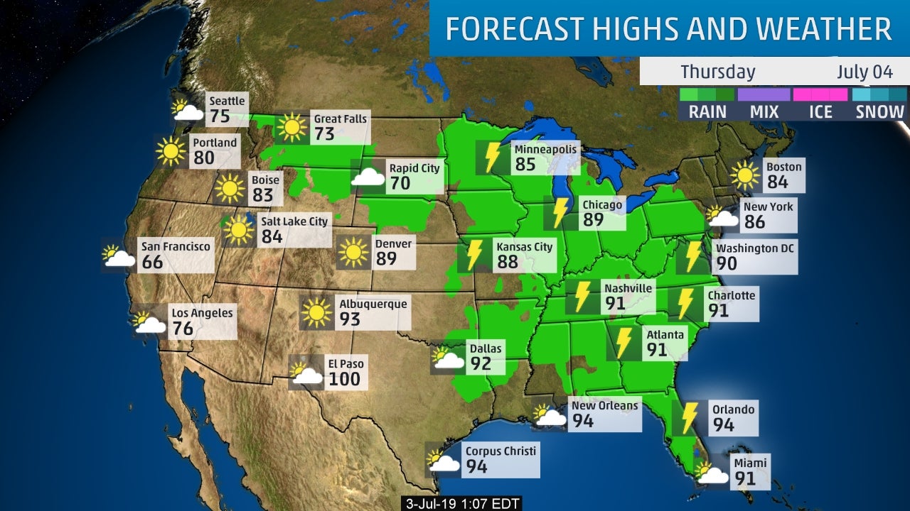
Lastly - snapshot weather for Thursday. Have a safe and happy 4th.

ANOTHER COLD FRONT HEADS THIS WAY, SO IT’S A HAZY HOT AND HUMID DAY WITH THUNDERSTORMS FORMING FROM THIS AFTERNOON INTO TONIGHT. TEMPS WILL...
Your Robin Hood Radio Tri-State Forecast TDY – CLOUDY- SHOWERS – MID 70S TNTE – CLOUDY- SPOTTY SHOWERS – 65-70 THURS – VARIABLY CLOUDY...

TDY – RAIN TAPERS TO WINTRY MIX – 35-40 TNTE- SOME SNOW ENDS…NEAR 30 SAT – CLOUDY- A PASSING RAIN OR WET SNOWSHOWER –...