
YOUR DAYTIME FORECAST:
TDY: SHOWERS TAPER OFF – 55-60
TNTE: CLOUDY- SPOTTY DRIZZLE – UPPER 30S
FRI: CLOUDY- SOME RAIN – 45-50
SAT: MOSTLY SUNNY – 50-55
SUN: SUN MIXING WITH CLOUDS – MID 50S
YOUR EVENING FORECAST:
TNTE: CLOUDY- SPOTTY DRIZZLE – UPPER 30S
FRI: CLOUDY- SOME RAIN – 45-50
SAT: MOSTLY SUNNY – 50-55
SUN: SUN MIXING WITH CLOUDS – MID 50S
WEATHER TRIVIA: 1980 – HURRICANE JEANNE DROPS 24” OF RAIN IN 24 HOURS ON KEY WEST, FL

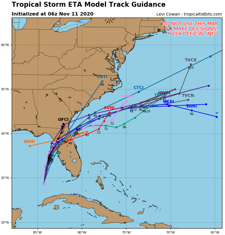
ETA - 65 mph winds - will head for west coast of Florida - between Cedar Keys and Clearwater today. After that it will rapidly northeast and merge with a cold front and pass off the SE Coast....into the Atlantic. Below - track by Hurricane Center and models....and a look at Atlantic basin map.


Satellite + radar above shows wet weather in Plains…some spilling over into Northeast. Cool West. Subtropical low east of Bermuda could be the first...

Pat Pagano in the Weather Center Share this:TwitterFacebookEmailLike this:Like Loading...
YOUR FORECAST: TODAY: MOSTLY CLOUDY WITH SHOWERS AND VERY WINDY – 60-65 – 50 BY EVENING TNTE: CLEAR- BRISK- 35-40 TUES: MOSTLY SUNNY BUT...