
TDY: SUN WITH INCREASING CLOUDS – 45-50
TNTE: CLOUDY- RAIN LATE – LOWER 40S
THANKSGIVING – PERIODS OF RAIN TAPERING OFF IN AFTERNOON – 50-55
FRI: CLOUDY- SOME SHOWERS – 60
SAT: PARTLY CLOUDY- SCATTERED SHOWERS – MID 50S
WEATHER TRIVIA: 1926 – PORTLAND ARKANSAS IS HIT BY TORNADO THAT KILLS 53.

Satellite + radar above shows cold air over the East with snowshowers in the lee of the Lakes. Rain and snow in the West....otherwise quiet is the word. Below - current track of Ioata - which will move into the Pacific and probably get a new name. Two other area of disturbed weather may form in the next few days.


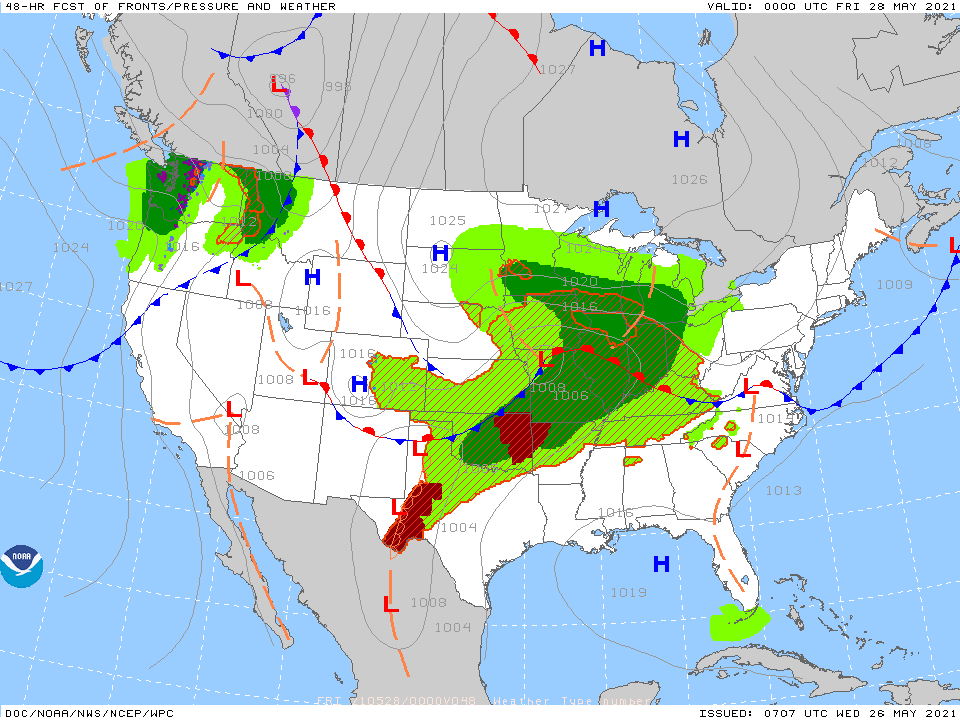
Below - animated maps....rainfall through Monday - snapshot weather for Thursday. Be extra safe.


Pat Pagano in the Weather Center Share this:TwitterFacebookEmailLike this:Like Loading...
Your Robin Hood Radio Tri-State Forecast TDY: CLOUDY- SOME RAIN OR DRIZZLE – MID 50S TNTE: CLOUDY- SOME DRIZZLE – 50 TUES: MAINLY CLOUDY-...
Pat Pagano started weather forecasting almost 40 years ago. He has over four decades of forecasting experience, starting with his college radio station and...
