
TDY: CLOUDY- SOME RAIN OR DRIZZLE – MID 50S
TNTE: CLOUDY- SOME DRIZZLE – 50
TUES: MAINLY CLOUDY- 55-60
WED: CLOUDY-MID 50S
THURS: RAIN DEVELOPING BECOMING HEAVY AT TIMES 55-60
WEATHER TRIVIA: 1859 – NEW YORK CITY’S EARLIEST SIGNIFICANT SNOWFALL OF 4”. WAS THAT BLAMED ON GLOBAL WARMING ?
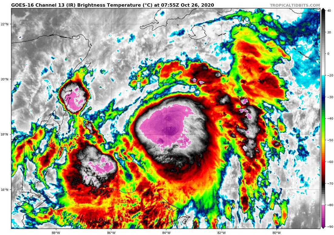
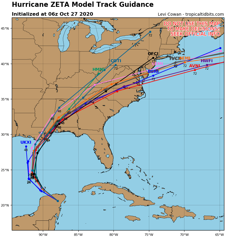
Tropical Storm Zeta....south of Cuba has 65 mph winds and will become a hurricane as it moves northwest into the Gulf of Mexico. A winter like storm in the Southwest will head east...and it will force Zeta toward Louisiana. After that they both combine and move northeast to bring a swath of heavy rains all the way to New England by Friday. Parts of New England may even see the rain end as wet snow on Friday. Below...Hurricane center track.....tracks of the models.


YOUR FORECAST: TDY: MOSTLY CLOUDY- HUMID -SHOWERS AND THUNDERSTORMS – 80 TNTE: SHOWERS AND A THUNDERSTORM – MID 60S SAT: SHOWERS – AFTERNOON CLEARING...

Your Robin Hood Radio Tri-State Forecast TODAY – MOSTLY CLOUDY, SCATTERED SHOWERS – 80 TONIGHT – CLOUDY- MID 60S TUESDAY – HAZY- HUMID –...
Anthony Jay Anthony is a graduate from Albany State with a degree in Broadcast Meteorology. He was top forecaster at SUNY Albany and won...