
TDY: MAINLY CLOUDY, SOME BREAKS OF SUN 55-60
TNTE: CLOUDY 40
WED: PARTLY CLOUDY 55-60
THURS: RAIN DEVELOPING & BECOMING HEAVY AT TIMES 50-55
FRI: WINDY WITH RAIN TAPERING OFF..POSSIBLY ENDING AS WET SNOW IN SOME AREAS 40
WEATHER TRIVIA: 1983 – TEMPS SOAR INTO 70S AND 80S ACROSS MONTANA AND WYOMING, THE DAKOTAS AND NEBRASKA.
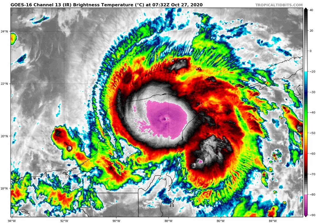
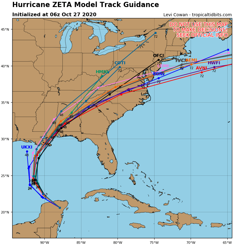
Hurricane Zeta with 75 mph winds is over the Yucatan and will head across the Gulf of Mexico making landfall close to New Orleans Wednesday night. This will be the 7th threat to New Orleans this season. After that - it will merge with a storm from the southwest and move off the New Jersey Coast Friday. Wind and rain all the way to the coast and then a mix or change to wet snow possible later Friday for Northeast. Below..
satellite picture....hurricane center track...tracks by the models.


WEATHER TRIVIA: 1930- LAKE EFFECT SNOWS DROP 48” JUST SOUTH OF BUFFALO, N.Y. WEATHER-CAST: A COLD HIGH PRESSURE SYSTEM WILL PROVIDE SUN…BUT BRISK AND...

Your Robin Hood Radio Tri-State Forecast CURRENT ADVISORIES: Heat Advisory in effect on Thursday, July 21 until 8pm. Heat index values of 95-100º across...
Atlantic Wakes Up ! Tropical Storm Gordon radar above…..with purple line showing its expected track to east of New Orleans tonight. Currently 60 mph...