
YOUR FORECAST:
TDY: HAZY – HOT – OPPRESSIVELY HUMID – MID 90S
TNTE: PARTLY CLOUDY- NEAR 70
TUES: MOSTLY SUNNY – NOT AS HOT OR HUMID – UPPER 80S
WED:SOME SUN- HUMID – CHANCE OF THUNDERSTORMS – LOWER 80S
THURS: HAZY- HUMID- SHOWERS AND THUNDERSTORMS – UPPER 80S
WEATHER TRIVIA:1977- JOHNSTOWN, PA AGAIN FLOODED BY 8 ½” OF RAIN IN 7 HRS.
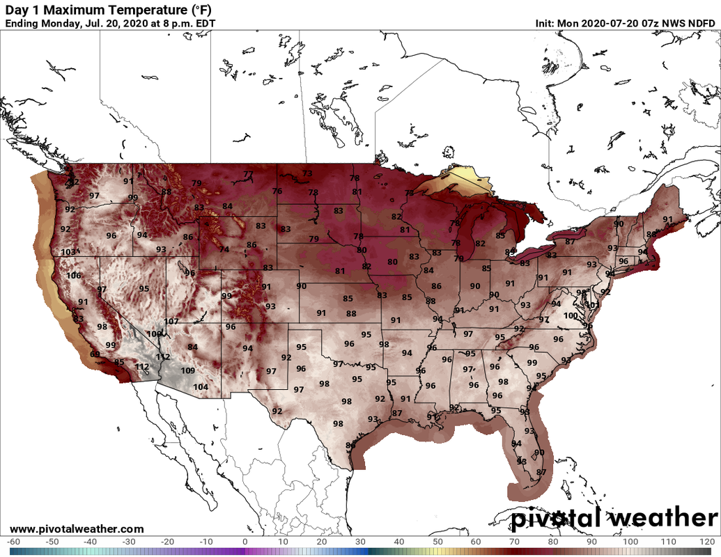
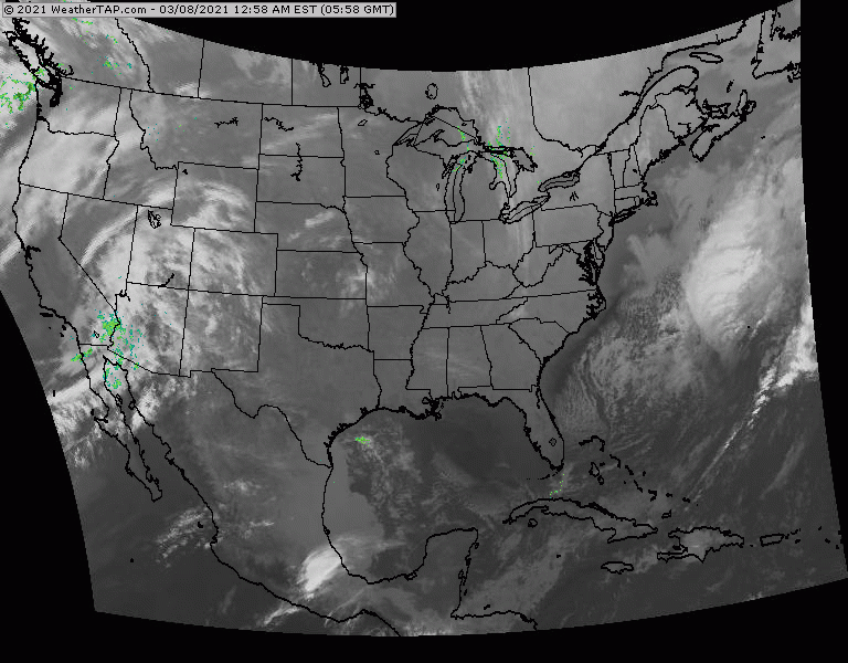
Above....projected high temperatures for today....and in the Northeast...it may actually be hotter than it was yesterday with some reading hitting 100 - real temps.....for first time this year. Below - satellite + radar....showing some storms over the Northeast - far and few between. Storms in Plains will be the next front arriving in the East on Wednesday.
Below - animated maps for the next 2 days.....severe weather for today....and rainfall through Friday.


Below - snapshot weather for Tuesday. Stay cool...check on the elderly...and be SAFE !


YOUR FORECAST: TDY: SOME SUN – LATE SHOWERS – MID 50S TNTE: CLOUDY- BREEZY – SHOWERS – LOWER 40S THURS: WINDY WITH SHOWERS AND...

Your Robin Hood Radio Tri-State Forecast TODAY: SOME SUN – AN EARLY A/O LATE STORM – 75-80 TONIGHT: SHOWERS END – 60 SAT: PARTLY...
Your Robin Hood Radio Tri-State Forecast TODAY – SOME SUN- CHANCE OF A SHOWER – 70 TONIGHT – PARTLY CLOUDY – 60 FRIDAY –...