
TDY: MOSTLY SUNNY – NOT AS HOT OR HUMID – UPPER 80S TO NEAR 90
TNTE: PARTLY CLOUDY – MID 60S
WED:SOME SUN- HUMID – CHANCE OF THUNDERSTORMS – MID 80S
THURS: HAZY- HUMID- SHOWERS AND THUNDERSTORMS – 85-90
FRI: PARTLY CLOUDY- LESS HUMID – MID 80S
WEATHER TRIVIA:1977- 10 DAY HEATWAVE WITH HIGHS NEAR 100 FINALLY ENDS IN THE EAST.
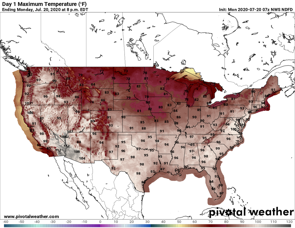
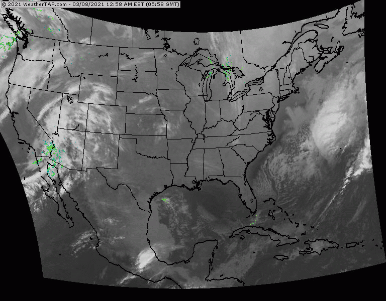
Above....projected high temperatures for today....and in the Northeast...it may actually be hotter than it was yesterday with some reading hitting 100 - real temps.....for first time this year. Below - satellite + radar....showing some storms over the Northeast - far and few between. Storms in Plains will be the next front arriving in the East on Wednesday.
Below - animated maps for the next 2 days.....severe weather for today....and rainfall through Friday.


Below - snapshot weather for Tuesday. Stay cool...check on the elderly...and be SAFE !


Independence Day: Mostly sunny, with a high near 87. Light and variable wind. Thursday Night: Patchy fog after 5am. Otherwise, partly cloudy, with a...

Your Robin Hood Radio Tri-State Forecast TDY – CLOUDY- SHOWERS DEVELOPING – 45-50 TNTE – PERIODS OF RAIN, DRIZZLE, FOG – 45-50 WED –...

Your Robin Hood Radio Tri-State Forecast TODAY – CLOUDY- SHOWERS AND A THUNDERSTORM – LOWER 70S TONIGHT – SHOWERS – SCATTERED STORMS – 55-60...