

YOUR FORECAST:
TDY: BECOMING CLOUDY- LATE RAIN – LOWER 50S
TNTE: PERIODS OF RAIN A/O WET SNOW. LIGHT ACCUMULATIONS POSSIBLE. –35-40
SAT: PERIODS OF RAIN OR WET SNOW FOLLOWED BY LATE CLEARING– LOWER50S
SUN: SUN THEN CLOUDS,LATE SHOWERS – LOWER 60S
MON: CLOUDY- SHOWERS – LOWER 60S
WEATHER TRIVIA:1965- FLOOD CREST AT ST.PAUL, MN., EXCEEDED PREVIOUS RECORD OF 4 FT.ONLY 12 LIVES LOST DUE TO TIMELY WARNINGS…DAMAGE OVER $100 MILLION.
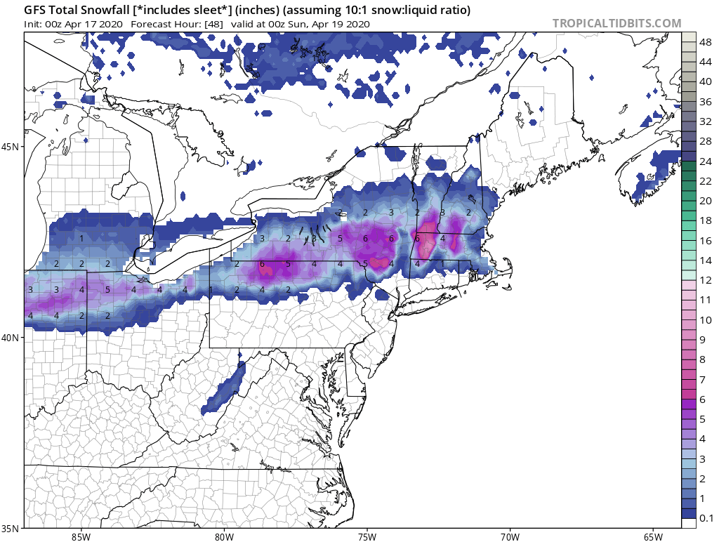
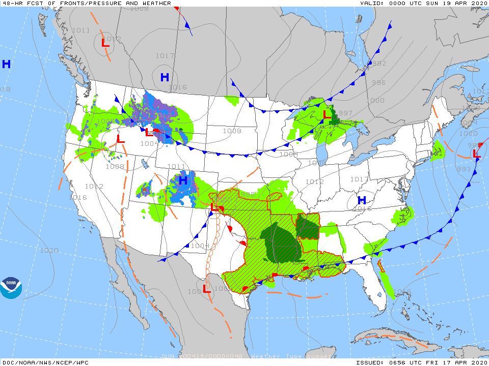
Above...snowfall predictions by GFS Model for Friday night into Saturday. Thinking is that it may be a bit too much...nevertheless...Saturday could be a "white" morning in these places. Below - satellite and radar showing storm moving into Ohio Valley...it will east to affect Northeast and Mid Atlantic tonight and Saturday.

Below - animated maps for next 2 days + total rainfall through Tuesday.


Below- snapshot weather. Please continue to stick to the rules...we are slowly overtaking this virus.

Your Robin Hood Radio Tri-State Forecast TDY: MAINLY CLOUDY- 35-40 TNTE: CLOUDY- UPPER 20S WED: PARTLY CLOUDY- BREEZY – 40 THURS: SUNNY- LOWER 40S...

YOUR FORECAST: TDY: SUNNY – MID 40S CHRISTMAS EVE: CLEAR- 15-20 CHRISTMAS DAY: SUNNY- 40 THURS: PARTLY SUNNY- 40 FRI: CLOUDY- SOME SPOTTY LIGHT...
Your Robin Hood Radio Tri-State Forecast TDY: A SHOWER OTHERWISE SOME SUN – MID 60S TNTE: CLEAR- CHILLY- 40 SAT & SUN: SUNNY- BREEZY-...