
YOUR FORECAST:
TDY: SUN AND CLOUDS- 40-45
TNTE: CLOUDY- UPPER 20S
SAT: CLOUDY…RAIN DEVELOPING..COULD START AS A WINTRY MIX INTHE HIGHER ELEVATIONS. 35-40
SUN: CLOUDY- SOME RAIN AND/OR WET SNOWSHOWERS – 35-40
MON: SOME SUN - 40
WEATHER TRIVIA:1963- GREAT ARCTIC OUTBREAK IN THE SOUTH: NASHVILLE, TN DROPS TO 15 BELOW
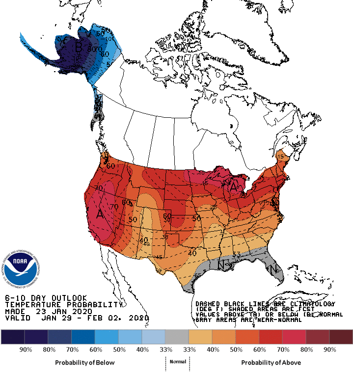
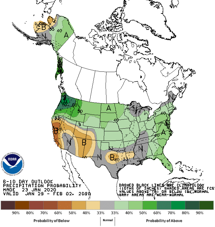
Above - NWS issued 6-10 day outlook through Feb.2nd. Above map - temperature trend.....below precipitation trend.
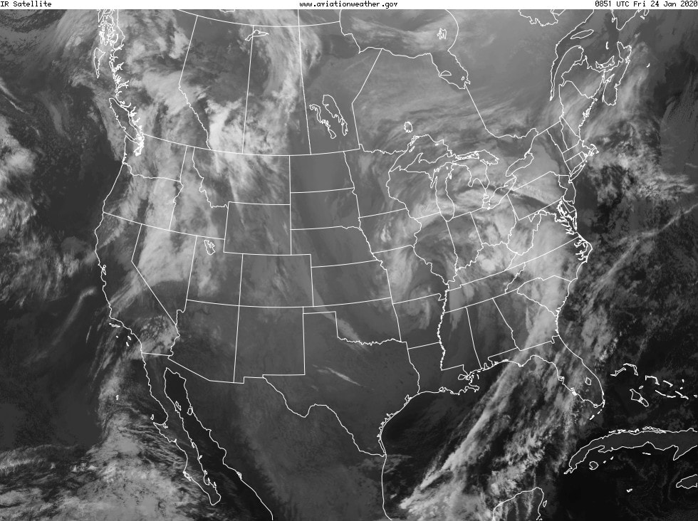
Above - satellite picture shows large storm from Plains to east Coast...likely to bring wet weather to much of the Eastern half of Nation..with snow confined from Upper Midwest to Gt.Lks and No. New England. Below - animated maps...snowfall and rainfall through Tuesday


Below- snapshot weather for Saturday . Enjoy your weekend and be safe.


Your Robin Hood Radio Tri-State Forecast TDY – PARTLY SUNNY – 75-80 TNTE – CLEAR – 55-60 TUES – SUN AND SOME CLOUDS –...
Your Robin Hood Radio Tri-State Forecast TODAY: HAZY – HUMID – A SHOWER OR THUNDERSTORM POSSIBLE – LOWER 90S TONIGHT: ANY SHOWERS END –...

YOUR FORECAST: TDY: PARTLY TO MOSTLY SUNNY - 40 TNTE: MOSTLY CLOUDY- LOWER 30S FRI: CLOUDY- PERIODS OF RAIN – MID 40S SAT: CLOUDY...