

CURRENT ADVISORIES : THERE IS AN ENHANCED RISK OF SEVERE WEATHER LATER TODAY INTO TONIGHT FOR CATSKILLS AND BERKSHIRES...SEVERE THUNDERSTORMS AND A POSSIBLE TORNADO.
YOUR FORECAST:
TDY: RAIN OR DRIZZLE THEN HAZY-BREEZY-WARM – SHOWERS AND A GUSTY THUNDERSTORM – MID 70S
TNTE: SHOWERS AND A THUNDERSTORM END – 55-60
SAT: PARTLY CLOUDY- 70-75
SUN: MAINLY CLOUDY- MID 60S
MON: COOL- PERIODS OF RAIN – MID 50S
WEATHER TRIVIA:1834- GREAT MAY SNOWSTORM FOR INTERIOR NEW ENGLAND: 30” NEWBURY, VT., 35F AT NANTUCKET, MA

Above...today's severe outlook. Enhanced threat in brown for Northeast. This area could see severe storms and tornadoes late today into tonight.
Below - satellite = radar- showing storms in Midwest moving eastbound.

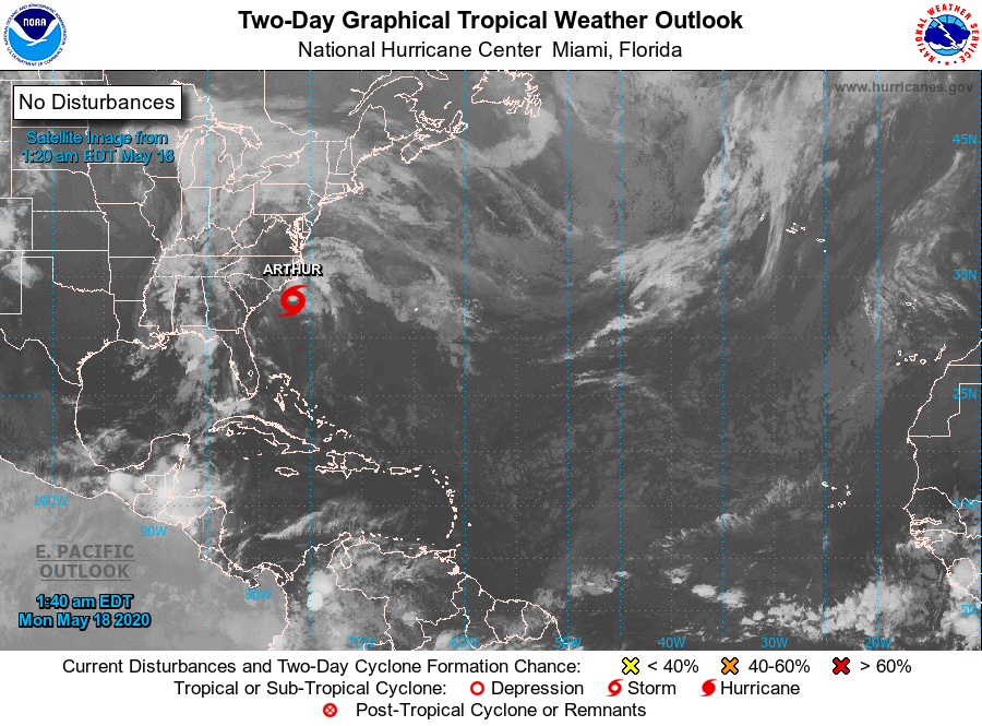
Below- tropical map showing a good potential for a tropical system forming near Florida and moving northeast. Hurricane center may investigate area today if needed.
Below - animated maps for thenext 2 days + rainfall through Saturday.


Below- snapshot weather for your Saturday. Please remember...this killer virus is not giving up. Everyone must wear masks and observe safe distance through the weekend.


Your Robin Hood Radio Tri-State Forecast TODAY –PARTLY SUNNY – MID 80S TONIGHT – PARTLY CLOUDY- 60 THURSDAY – SUNNY THEN CLOUDY– MID 70S...

Your Robin Hood Radio Tri-State Forecast TODAY– MOSTLY SUNNY AND BREEZY – 60 TONIGHT – CLOUDY- 40 TUESDAY – VARIABLY CLOUDY- LATE SHOWERS –...

Your Robin Hood Radio Tri-State Forecast CURRENT ADVISORIES – HEAT ADVISORY TODAY – SUNNY- HOT – HUMID – 90-95 TONIGHT – CLEAR – 65-70...
