

YOUR FORECAST:
TODAY: MOSTLY CLOUDY- SOME SHOWERS – 60
TNTE: CLOUDY- MID 40S
TUES: PARTLY SUNNY – BREEZY – MID 60S
WED: SUNNY- BREEZY – 65-70
THURS: SOME SUN – 65-70
WEATHER TRIVIA:1980….MT. ST. HELENS ERUPTS….ASH PLUME CROSSED THE COUNTRY IN 3 DAYS.
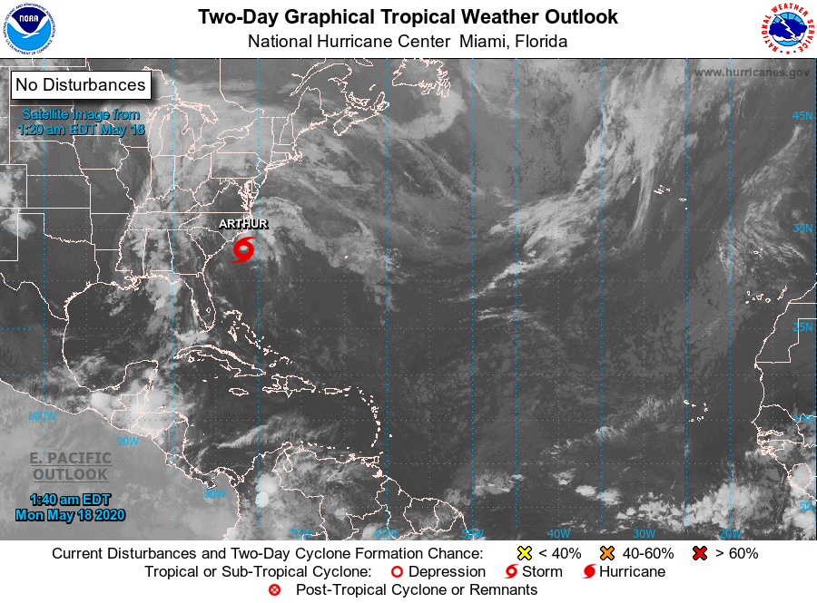
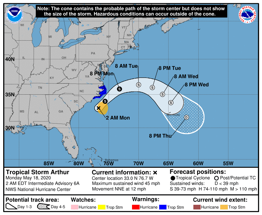
Tropical Storm Arthur with 45-50 mph winds will skirt N.Carolina with wind and rain and then turn east out into the Atlantic. Below- expected track.
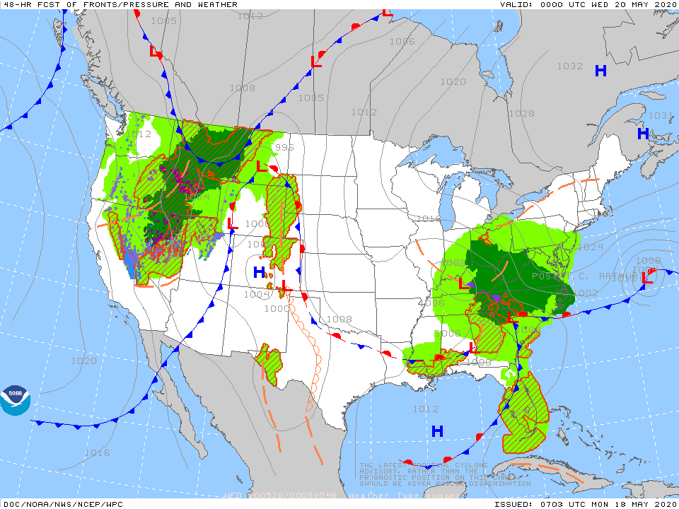
Below - satellite + radar for the Nation showing wet weather from Great Lakes south. That area will move southeast to affect the Mid Atlantic and Southeast keeping the Northeast mainly dry after today.

Below - today's risk of severe weather in dark green...animated maps...rainfall through Friday.


Below- snapshot weather for Tuesday. BE SAFE !!!!

WEATHERCAST: AS HIGH PRESSURE SLIDES EAST FROM THE MIDWEST- PARTLY SUNNY SKIES TODAY BRING TEMPS INTO THE LOWER 80S…..THEN CLEAR IN THE 50S TONIGHT....

Your Robin Hood Radio Tri-State Forecast TDY – PARTLY SUNNY – 75-80 TNTE – CLEAR – 55-60 TUES – SUN AND SOME CLOUDS –...
Your Robin Hood Radio Tri-State Forecast TODAY: VARIABLY CLOUDY- 35-40 TONIGHT: CLOUDY- UPPER 20S TUES: MAINLY CLOUDY- 35-40 WED: MOSTLY CLOUDY- BREEZY – 40...