

YOUR FORECAST:
TDY: PARTLY SUNNY – MODERATELY HUMID – CHANCE OF SHOWERS &
THUNDERSTORMS- LOWER 80S
TNTE: PARTLY CLOUDY- SHOWER OR THUNDERSTORM – MID 60S
TUES: SUN AND CLOUDS, SHOWERS AND STORMS – 75-80
WED: VARIABLY CLOUDY- SCATTERED SHOWERS & STORMS – LOWER 80S
THURS: PARTLY CLOUDY- STILL A SHOWER OR THUNDERSTORM - 80
WEATHER TRIVIA:
1954 – Hurricane Alice dumps 27” of rain on lower Rio Grande Valley River. At
Laredo, river stage was 12ft above the previous high mark.

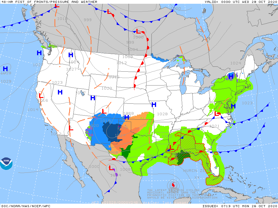
Satellite & radar show areas of unsettled weather across the Nation and the week looks to be unsettled right into the 4th of July weekend.
Below - latest picture concerning dust cloud.

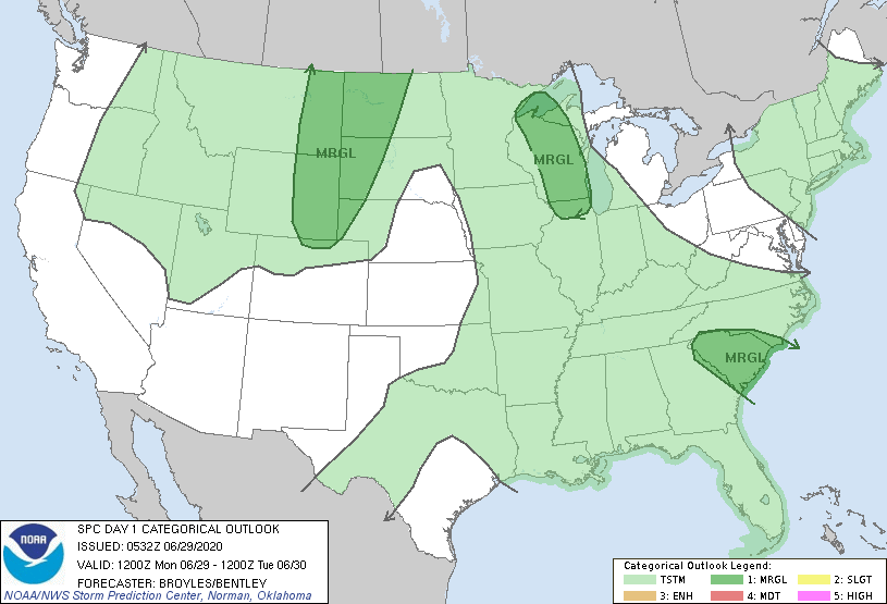
Below - today's risk of severe storms....animated maps.....rainfall through Friday.


Below - current tropical map plus snapshot weather for Tuesday.
Be safe and stick to the rules.


TDY: PARTLY SUNNY- NOT AS HARSH – LOWER 20S TNTE: CLEAR – 5 TO 10 ABOVE SAT: PARTLY SUNNY – 30 SUN: MOSTLY CLOUDY-...
YOUR FORECAST:TODAY THRU THURSDAY: HAZY – HUMID – SCATTERED SHOWERS AND THUNDERSTORMS EACH DAY. HIGHS 85-90 TONIGHT: A SHOWER OR THUNDERSTORM OTHERWISE PARTLY CLOUDY-...
WEATHER TRIVIA: 1979 – BOSTON’S EARLIEST SNOWFALL = ¼”…..UP TO 1 FOOT IN PARTS OF W.VA. WEATHER-CAST HAZY WARM AND HUMID WEATHER IS ON...