
TDY: SUNNY- DRY BREEZE – 80-85
TNTE: CLEAR- 55-60
FRI: SUNNY TO PARTLY CLOUDY- LOWER 80S
SAT: SUNNY- MID 70S
SUN: INCREASING CLOUDS – MID 70S
WEATHER TRIVIA:1965 – 2.5” SNOW AT MT.WASHINGTON, N.H. – 20’S IN CONN., 39 ON CAPE COD,MA.
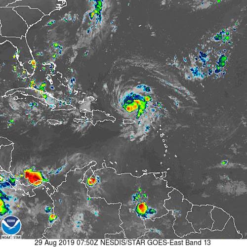
Satellite above shows Dorian to continue to intensify with 85+ mph winds. He is expected to become a CAT 3 as he approaches Florida - Sunday/Monday. Most of the hurricane models aim for Central Fla., but the Euro continues to insist on So. Florida...and then up the East Coast.
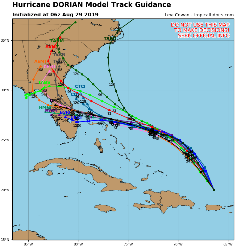
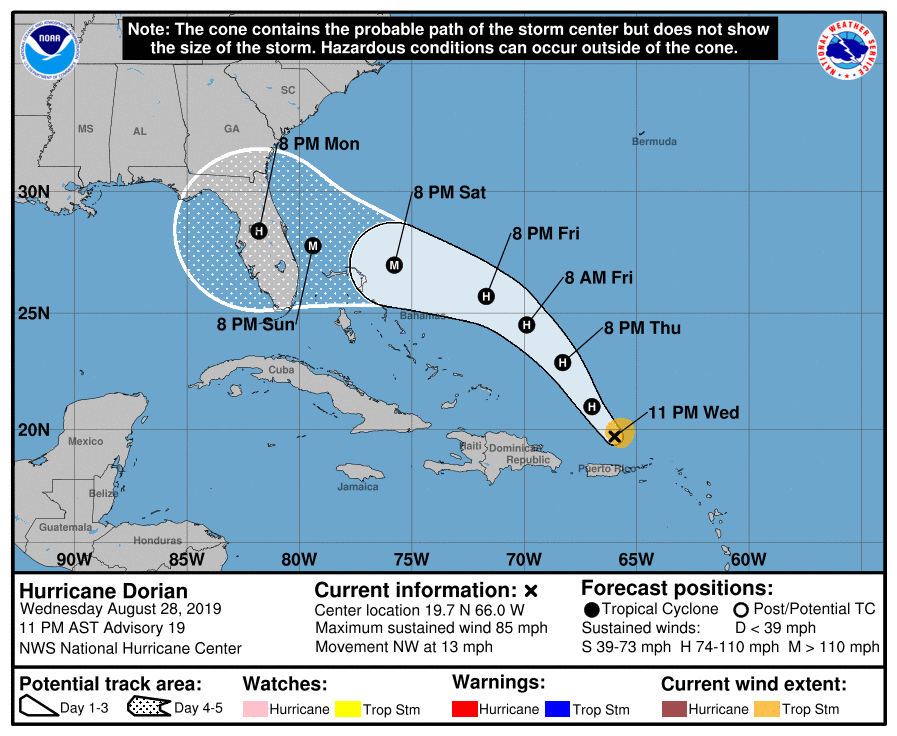
In any event...The SE U.S. has to be on alert. Below - tracks by the various computer models...followed by official track of The Hurricane Center.
Below - today's risk of severe weather in dark green and yellow....animated maps for next 2 days....rainfall into Tuesday of next week.


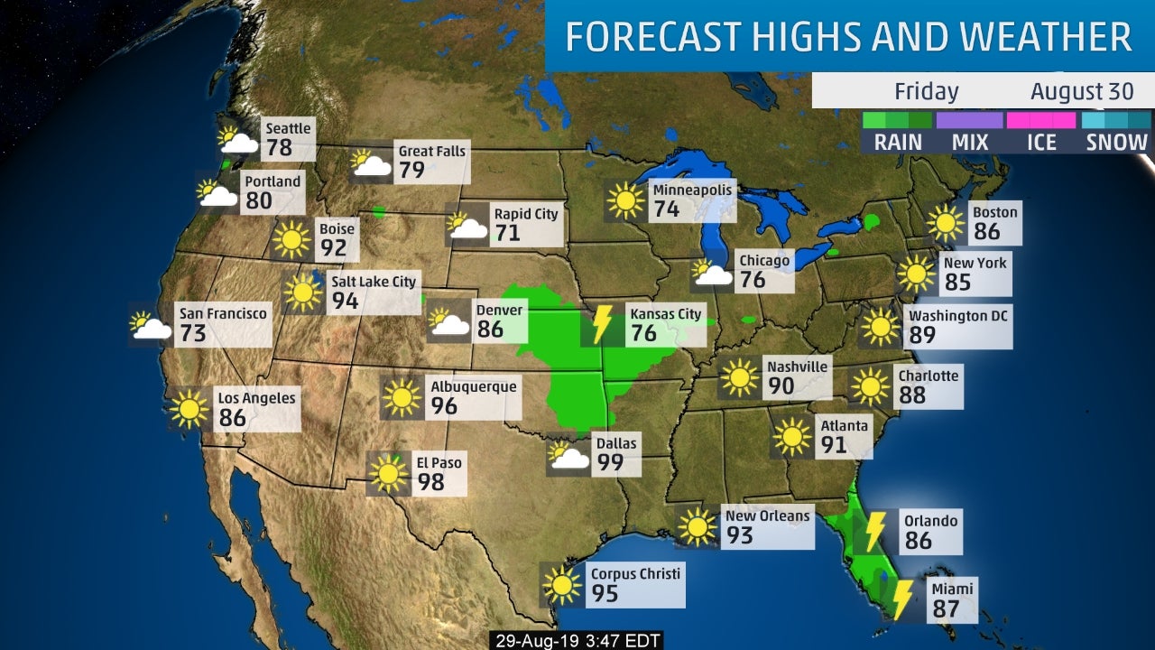
Below- snapshot weather for Friday. Be safe.

Record Cold Heads For The Northeast….. 11/9/2017 0 Comments Olf front in Southeast causing rain. Arctic cold front – from Great Lakes to Rockies...

URGENT - WINTER WEATHER MESSAGE National Weather Service Albany NY 333 AM EST Wed Feb 23 2022 Northern Litchfield-Southern Litchfield-Northern Berkshire- Southern Berkshire-Western Greene-Eastern...
Today: Rain, mainly after 2pm. High near 47. East wind 7 to 10 mph. Chance of precipitation is 90%. New precipitation amounts between a...