
YOUR FORECAST:
TDY: SOME SUN – LATE SHOWERS – LOWER 80S
TNTE: SHOWERS – LOWER 60STHURS: SUNNY- DRY BREEZE - 80
FRI: SUNNY TO PARTLY CLOUDY- 80
SAT: SUNNY- MID 70S
WEATHER TRIVIA:1961 – HEAVY RAIN FROM TROPICAL STORM DORIA CAUSED FLOODS IN NO. NEW JERSEY WITH DAMAGE OF $138 MILLION.
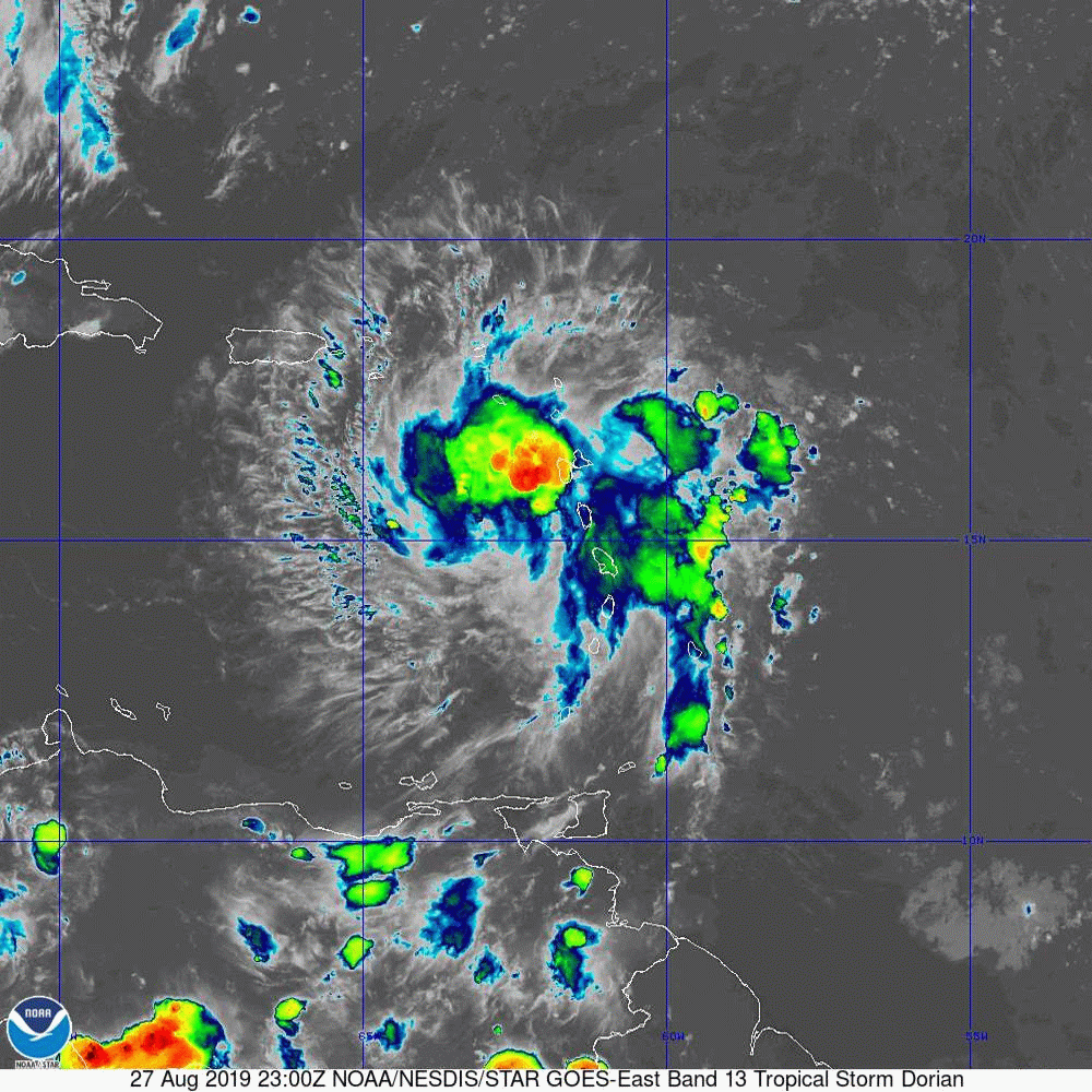
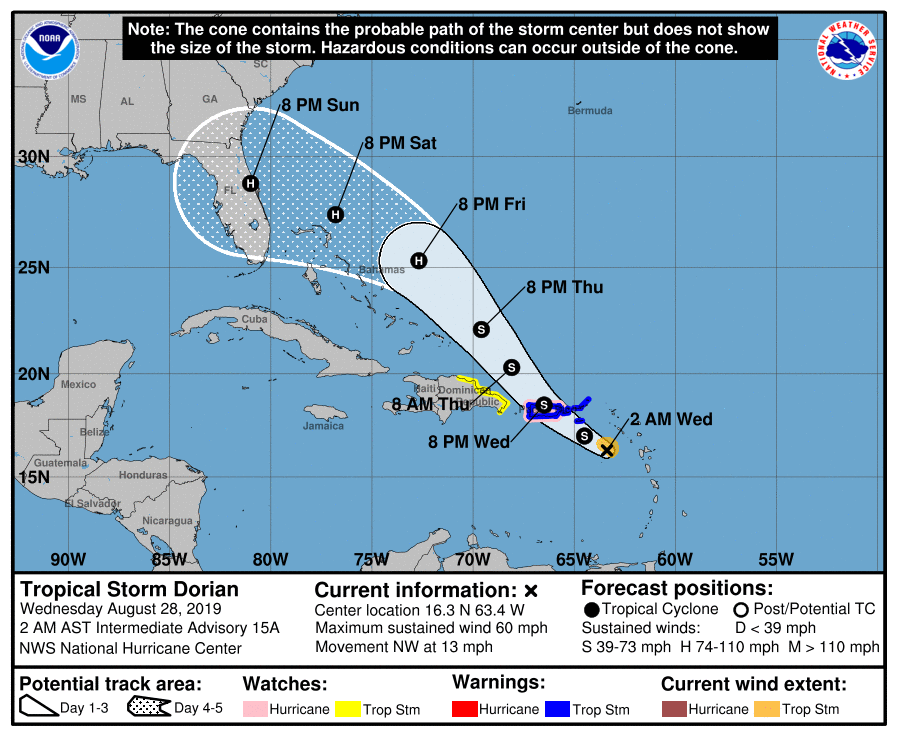
Dorian has 60+ mph winds and lots of rain and will move across Puerto Rico today...result cannot be good. After that...it is a tough call. Most models bring it toward Florida...some keep it along the coast and head for the Carolinas next week...so it will have to be watched like all tropical systems. Below - hurricane center track...followed by tracks from computer models.

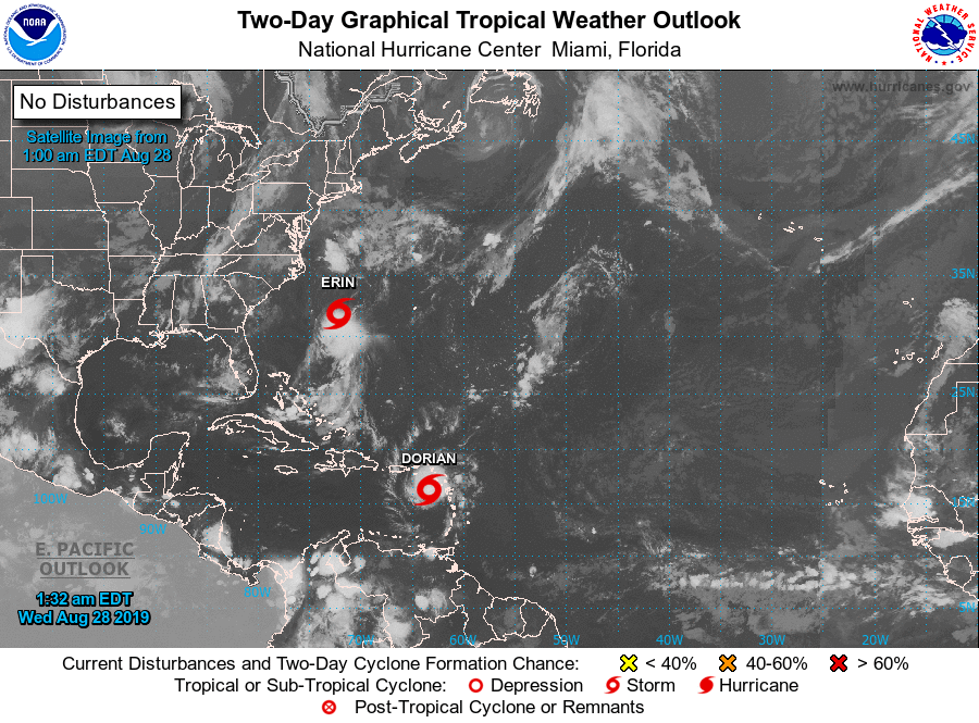
Below- satellite picture showing Dorian and now Erin...which will move
out into the Atlantic. Following that - animated maps for the next 2 days followed by rainfall through Sunday.


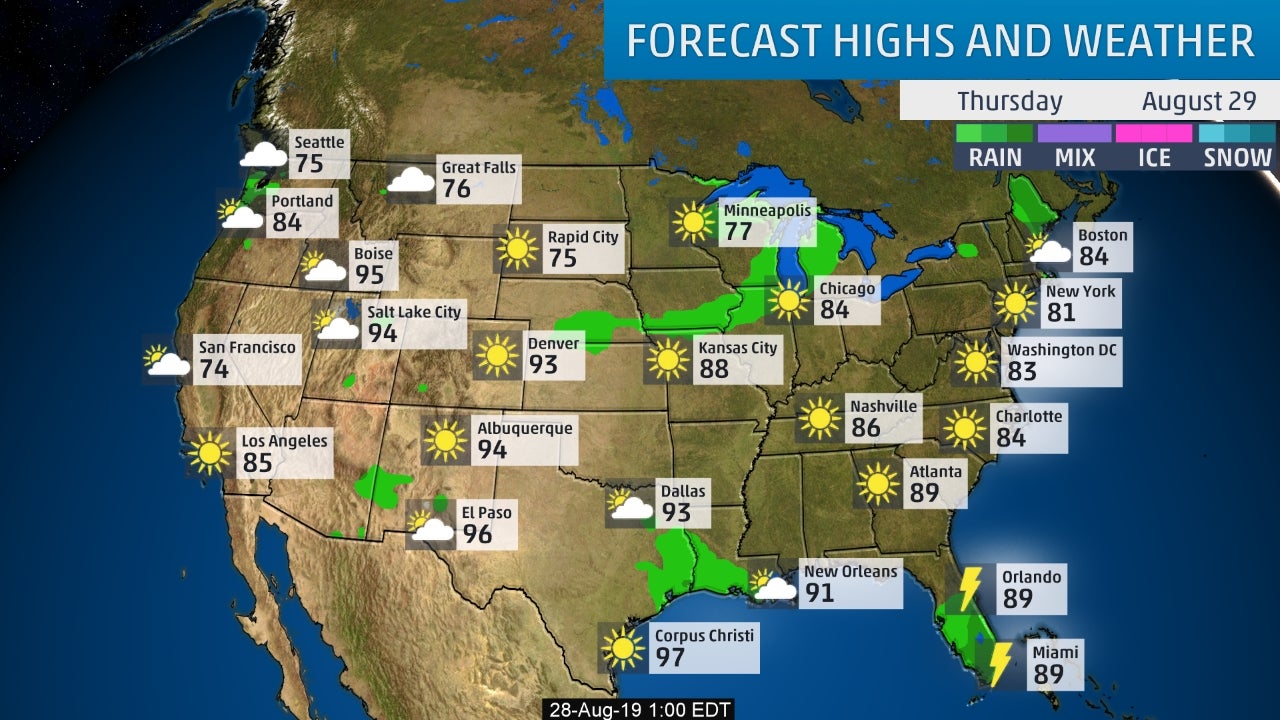
Lastly - snapshot weather for your Thursday. Be safe.

YOUR FORECAST: TODAY: SUN MIXING WITH CLOUDS – MID 60S TNTE: CLOUDY- SOME RAIN AND DRIZZLE – MID 40S TUES: SOME RAIN OR DRIZZLE...

Your Robin Hood Radio Tri-State Forecast WED: HAZY – HUMID – SCATTERED SHOWERS AND GUSTY THUNDERSTORMS – 85-90 THURS: PARTLY SUNNY – LESS HUMID...
WEATHER TRIVIA: 1985 – 1 MIILLION PEOPLE EVACUATE GULF COAST IN ADVANCE OF HURRICANE ELENA, 1.5 BILLION IN DAMAGES. WEATHER-CAST OUR FRONT HAS STALLED...