
YOUR FORECAST:
TDY: HAZY – HUMID – LATE DAY OR EVENING THUNDERSTORMS – MID 80S
TNTE: SHOWERS, SCATTERED THUNDERSTORMS - 70
FRI: SHOWERS AND STORMS END, PARTLY SUNNY- HOT- HUMID – LOWER 90S
SAT: PARTLY SUNNY- HOT – MODERATELY HUMID – 90
SUN: CONTINUED PARTLY SUNNY – LITTLE LESS HUMID – MID 80S
WEATHER TRIVIA:1888- MT. WASHINGTON, N.H. – HEAVY SNOW….PEAKS OF GREEN MOUNTAINS, WHITENED.
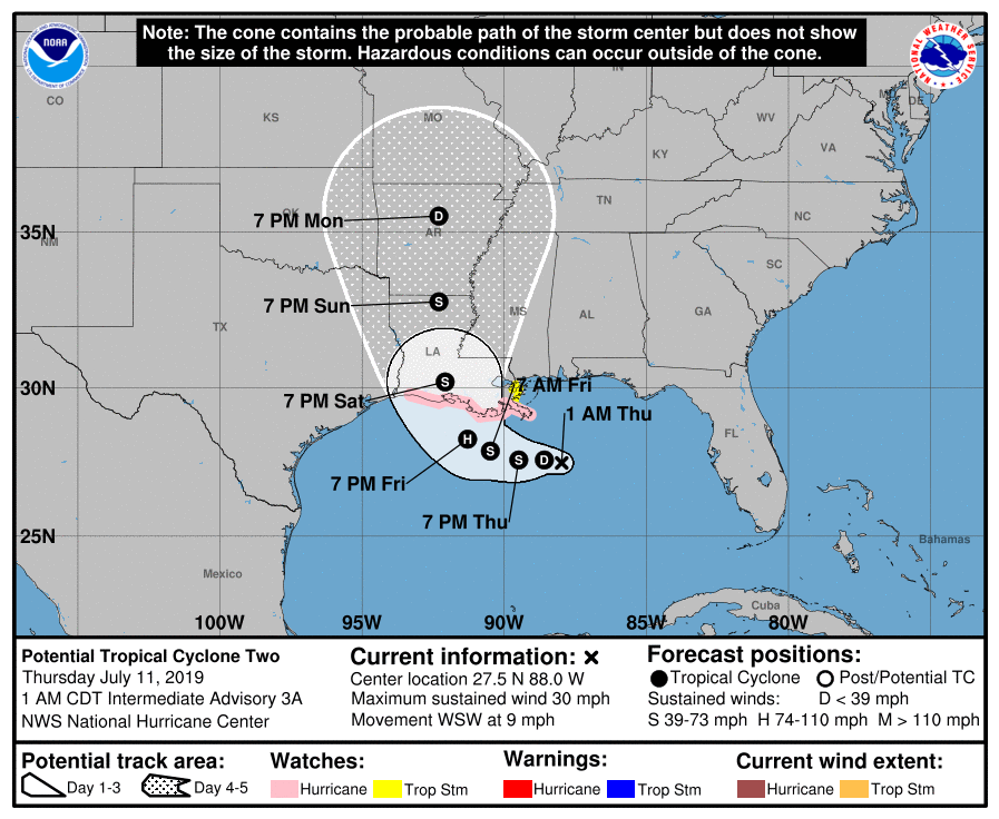
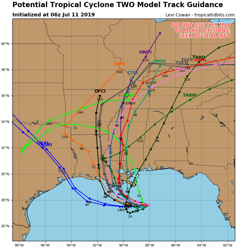
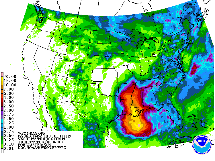
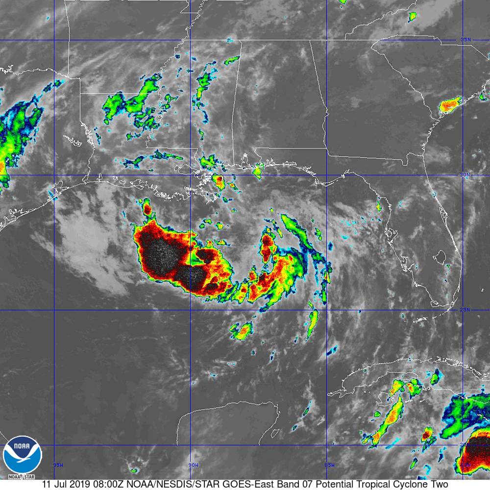
Above - satellite picture showing tropical disturbance in Gulf which will become a depression today and then Tropical Storm Barry or even a Hurricane Friday into the weekend. Following...hurricane center track followed by tracks of different models. Most agree...Louisiana....and since system is moving slowly....very heavy rainfall likely...over 10".
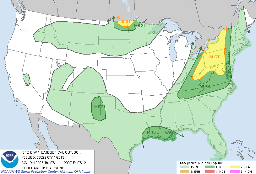
Below - today's risk of severe weather - dark green and yellow - followed by animated maps....and rainfall into MOnday.
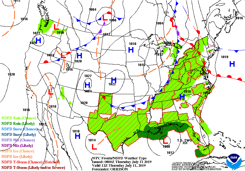
Below - satellite + radar showing cold front moving out of Gt. Lakes and into East today with showers and storms. Snapshot weather for Friday.
Be safe.


..HEAT ADVISORY REMAINS IN EFFECT FROM 11 AM THIS MORNING TO 7 PM EDT THIS EVENING… * Location…the mid Hudson Valley and southern Taconics...

Your Robin Hood Radio Tri-State Forecast CURRENT ADVISORIES: HEAT ADVISORY –TO 8PM FRIDAY TODAY – PARTLY CLOUDY - HUMID WITH SOME SHOWERS AND THUNDERSTORMS...
Your Robin Hood Radio Tri-State Forecast TDY: HAZY – HUMID – 85-90 TNTE: CLOUDY- SHOWERS - 70 SAT: CLOUDY- OCC’L RAIN, MAYBE A THUNDERSTORM...