
YOUR FORECAST:
TDY: SUNNY- A BIT MORE HUMID – 90
TNTE: PARTLY CLOUDY – MID 60S
THURS: HAZY – HUMID – LATE DAY OR EVENING THUNDERSTORMS – MID 80S
FRI: SHOWERS AND STORMS END, PARTLY SUNNY- HOT- HUMID – LOWER 90S
SAT: PARTLY SUNNY- HOT – MODERATELY HUMID - 90
WEATHER TRIVIA:1913 – DEATH VALLEY, CALIFORNIA HITS 134 F – HOTTEST EVER IN THE U.S.

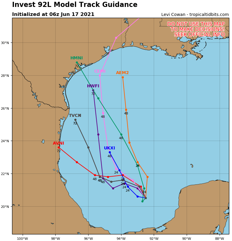
A tropical disturbance forming in the Gulf will likely become either Tropical Storm or Hurricane Barry by this weekend. The storm will likely take aim on Louisiana. Below - another satellite picture and the tracks by different models.

Meanwhile a cold front in the Plains will result in severe weather which will head east and affect the Eastern Seaboard later Thursday into Friday.
Below - radar + satellite pix - followed by severe outlook for today.


Following maps - animated - showing track of tropical system - amounts of rainfall through SUnday......over 7" across parts of the Gulf States.


Lastly -snapshot weather for Thursday.


Your Robin Hood Radio Tri-State Forecast TDY: PARTLY SUNNY – 25-30 TNTE: CLOUDY- MID TEENS TUES: PERIODS OF SNOW – 2”- 4” – 30...

URGENT - WINTER WEATHER MESSAGE National Weather Service Albany NY 333 AM EST Wed Feb 23 2022 Northern Litchfield-Southern Litchfield-Northern Berkshire- Southern Berkshire-Western Greene-Eastern...

Your Robin Hood Radio Tri-State Forecast TODAY – CLOUDY- WINDY- A FEW SHOWERS – 45-50 TONIGHT – SHOWERS END – PARTLY CLOUDY – 40...
