

YOUR FORECAST:
TDY: SUNNY- BREEZY – 65-70
TNTE: CLEAR-NIPPY- 40
THURS: SUNNY – LOWER 70S
FRI: SUNNY AND WARM – 75-80
SAT: PARTLY CLOUDY – MID 70S
WEATHER TRIVIA:1952 – TORNADO TRACK OF 71 MILES KILLS 48 IN KANSAS CITY SUBURBS

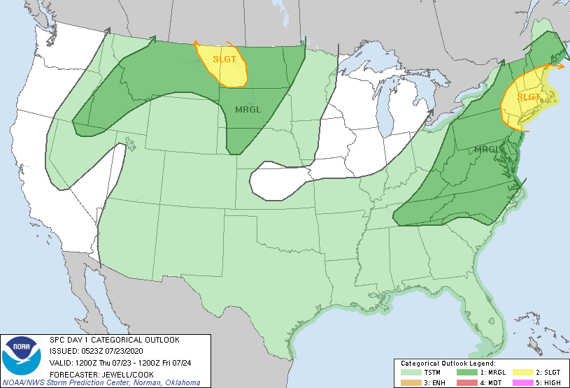
Satellite-radar shows storms over the Plains....rain over The Appalachians. That area of rain heads north so that the holiday weekend begins wet for the Northeast...but Northern New England stays dry. Below - animated maps...rainfall through Monday - severe risk for today.


Below - latest pollen report & snapshot weather for Friday.
Be safe.


YOUR FORECAST:
TDY: SUNNY – LOWER 70S
TNTE: CLEAR – COOL – LOWER 40S
FRI: SUNNY AND WARM – 75-80
SAT: CLOUDY, SHOWERS – MID 60S
SUN: CLOUDS AND SOME SUN – LOWER 70S
WEATHER TRIVIA:
1860- TORNADO SWARM IN OHIO VALLEY HITS LOUISVILLE & CINCINNATI.

Share this:TwitterFacebookEmailLike this:Like Loading...
WINTER STORM WARNINGS -4PM SATURDAY TO 4PM SUNDAY WEATHER TRIVIA:1961 – 16 CONSECUTIVE DAYS OF BELOW 32F ACROSS THE MID ATLANTIC STATES. YOUR FORECAST: ...

URGENT - WINTER WEATHER MESSAGE National Weather Service Albany NY 333 AM EST Wed Feb 23 2022 Northern Litchfield-Southern Litchfield-Northern Berkshire- Southern Berkshire-Western Greene-Eastern...