

YOUR FORECAST:
TDY: SUNNY AND WARM – 75-80
TNTE: CLOUDY – SHOWERS DEVELOPING - 60
SAT: CLOUDY, SHOWERS – 70
SUN: MAINLY SUNNY – LOWER 70S
MON: SUN AND CLOUDS – LOWER 70S
WEEKEND WEATHER INDEX IS A 5 OUT OF A 10 !PERFECT
WEATHER TRIVIA:1980 – TEMPERATURE SOARS TO 106 @ WILLISTON, S.D

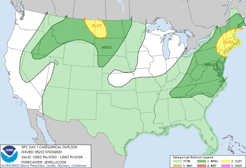
Satellite-radar shows storms over the Plains....rain over The Appalachians. That area of rain heads north so that the holiday weekend begins wet for the Northeast...but Northern New England stays dry. Below - animated maps...rainfall through Monday - severe risk for today.


Below - latest pollen report & snapshot weather for Friday.
Be safe.


YOUR FORECAST: TDY: PARTLY CLOUDY- HUMID, 85-90 TNTE:CLEAR- MID 60S SAT: PARTLY SUNNY – MODERATELY HUMID – 85-90 SUN: HAZY- HOT-HUMID – 90-95 MON:...
Not much happening on satellite & radar except in Northwest. That trend continues but will change big time by late weekend. Below…current weather map...
Share this:TwitterFacebookEmailLike this:Like Loading...