WINTER WEATHER ADVISORY IN EFFECT FROM TUESDAY AFTERNOON THROUGH WEDNESDAY MORNING...
* WHAT...Heavy snow possible. Total snow accumulations of 4 to 7 inches possible. * WHEN...From Tuesday afternoon through Wednesday morning. Snow begins Tuesday afternoon and becomes steady by Tuesday evening. Snow, possibly heavy at times, continues Tuesday night before ending by daybreak Wednesday.
TDY: CLOUDY WITH A WINTRY MIX - MID 30S
TONITE: WINTRY MIX CHANGES TO SNOW – MID 20S- ACCUMULATIONS OF 3”-5”.
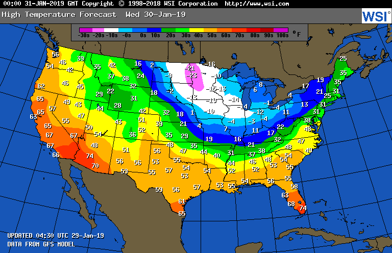
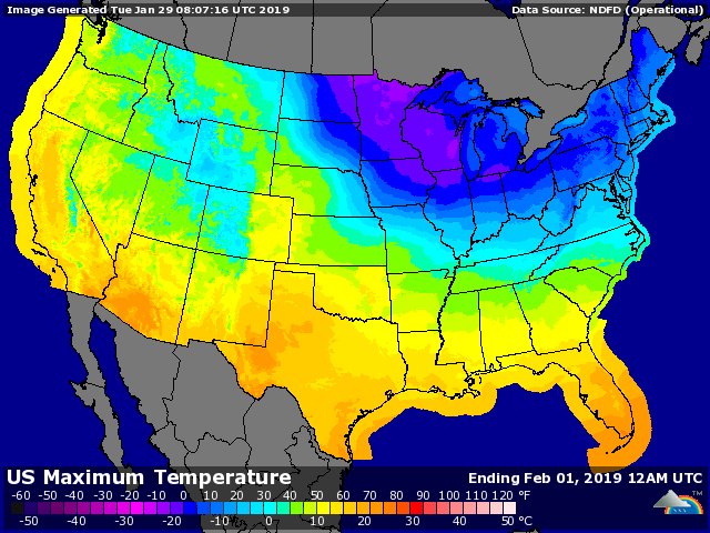
WEDS: WINDY AND COLD WITH SNOW SHOWERS – 20S AND FALLING
THURS: SUNNY TO PARTLY CLOUDY- WINDY AND STINGING COLD – 10 TO 15
FRI: SUNNY - NOT AS HARSH – MID 20S
WEATHER TRIVIA:1966- SCHOOLS CLOSE FOR 1 WEEK IN THE EAST AS 1 TO 3 FEET OF SNOW ARE WHIPPED INTO 15 FOOT DRIFTS.


Today Mostly sunny, with a high near 75. Northwest wind 10 to 14 mph. Tonight Mostly clear, with a low around 49. North wind...
TDY: SHOWERS FOLLOWED BY SOME AFTERNOON CLEARING – MID 60S TNTE:PARTLY CLOUDY- MID 40S SAT: PARTLY SUNNY – MID UPPER 60S SUN: SUN THEN...

Your Robin Hood Radio Tri-State Forecast TODAY– SUN AND CLOUDS, BRISK – LOWER 40S TONIGHT – CLEAR – 20-25 WEDNESDAY – SUNNY- MID 40S...