YOUR FORECAST:
TODAY: PARTLY SUNNY AND TURNING MORE HUMID – 90
TNTE: CLOUDY- A SHOWER OR THUNDERSTORM – MID 70S
WED: HAZY – HUMID – SHOWERS AND SCATTERED THUNDERSTORMS – MID 80S
THURS: CLOUDY & HUMID – SHOWERS AND THUNDERSTORMS - 80
WEATHER TRIVIA:1987 – THUNDERSTORMS IN NEW JERSEY PRODUCE 2 TORNADOES: 1 NEAR TRENTON AND OTHER NEAR NEWARK.
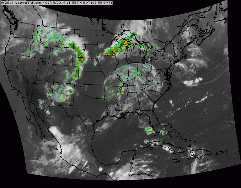
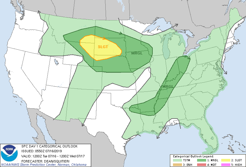
The remains of Barry is Missouri and that combined with a cold front in the Great Lakes is producing showers and storms Midwest and Ohio Valley. Another front producing storms into the Plains. Below - today's risk of severe thunderstorms in dark green and yellow.
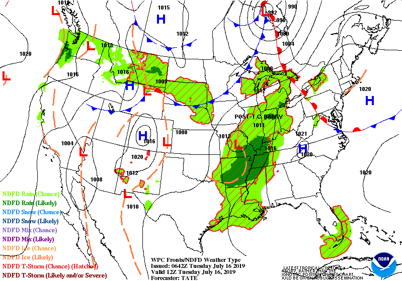
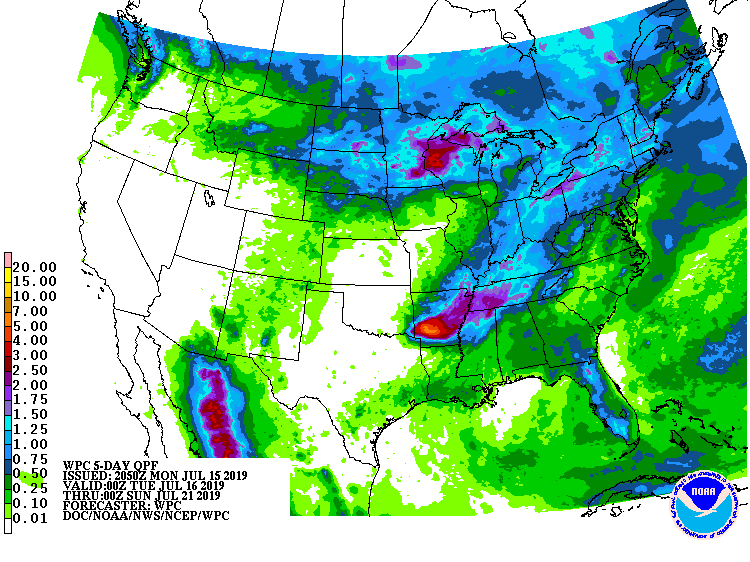
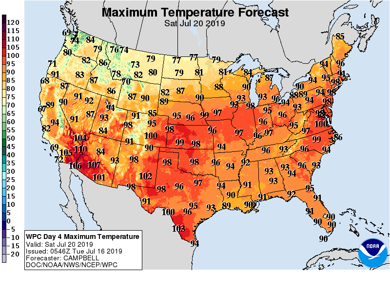
Below - animated maps for the next couple followed by rainfall into the weekend. The current pattern not only favors above norm temps...but a strong heatwave which will poke into The Northeast this weekend bringing temps to 100 in some of the major cities.
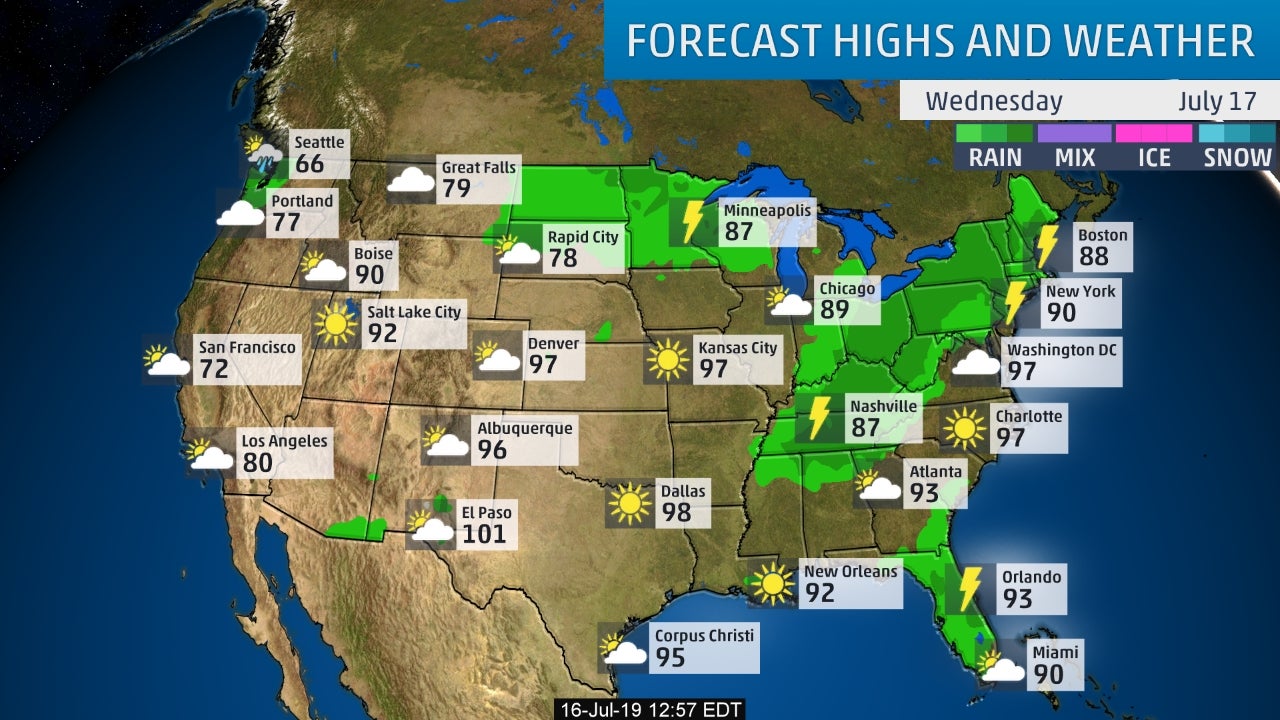
Below - snapshot weather for Wednesday - followed by projected high temps for Saturday. Anywhere in red has the potential of reaching 100.
Be safe.

URGENT - WINTER WEATHER MESSAGE National Weather Service Albany NY 333 AM EST Wed Feb 23 2022 Northern Litchfield-Southern Litchfield-Northern Berkshire- Southern Berkshire-Western Greene-Eastern...

ADVISORIES: WINTER WEATHER ADVISORY…..EXCEPT WINTER STORM WARNINGS – BERKSHIRES. WEATHERCAST: AS A STORM IN THE TENNESSEE VALLEY HEADS NORTHEAST, A WINTRY MIX WILL SPREAD...
Share this:TwitterFacebookEmailLike this:Like Loading...