
YOUR FORECAST:
TDY: HAZY – HUMID – SHOWERS AND SCATTERED THUNDERSTORMS, SOME MAY BE SEVERE – MID 80S
TNTE: SHOWERS AND THUNDERSTORMS – LOWER 70S
THURS: CLOUDY & HUMID – SHOWERS AND THUNDERSTORMS - 80
FRI: PARTLY CLOUDY- HOT – HUMID – LOWER 90S
WEATHER TRIVIA:1941- PROLONGED HEATWAVE IS WASHINGTON STATE ENDS WITH THUNDERSTORMS THAT SET OFF 600 SERIOUS FOREST FIRES.
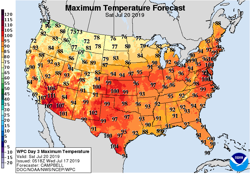
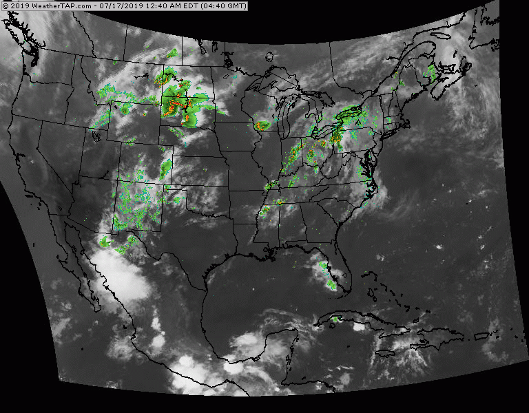
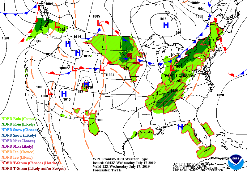
Above...projected temperatures for this Saturday. 100 + actual temperatures from Southwest to Northeast...and when combined with oppressive humidity...it will feel like 110 to 120 F. Below - satellite and radar showing showers and storms headed east from Great Lakes into Northeast today and Thursday...some of which will be severe.
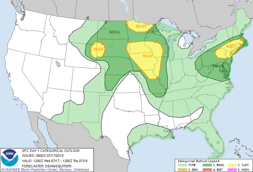
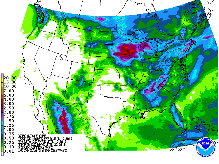
Below- today's risks of severe weather dark green and yellow.....followed by projected rainfall into Monday of next week.
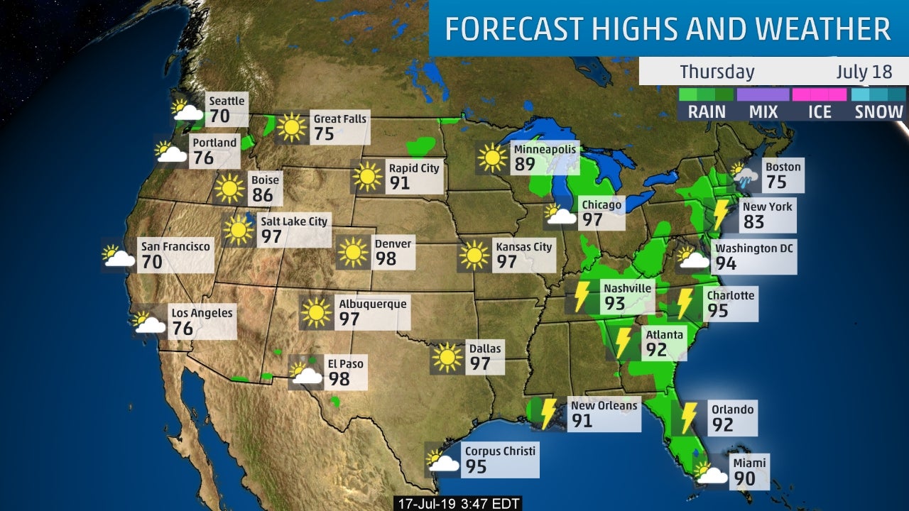
Below - animated maps for the next couple...followed by snapshot weather for Thursday. We will be posting heatwave safety rules tomorrow. Be safe.

...WINTER WEATHER ADVISORY REMAINS IN EFFECT UNTIL NOON EDT SATURDAY... * WHAT...Snow. Total snow accumulations of 2 to 6 inches. Winds gusting as high...
Your Robin Hood Radio Tri-State Forecast TODAY: SUNNY- BIT MORE HUMID – MID 80S TNTE: CLEAR – LOW TO MID 60S WED: PARTLY SUNNY...
WEATHER TRIVIA: 1977- HEAVY RAINS CAUSE DAM TO BREAK AND FLOOD AT TACCOA, GEORGIA – KILLING 38. WEATHER-CAST: THE WEATHER BALLOT SHOWS 2 POTENTIAL...