
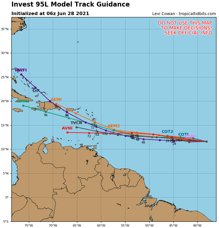
Satellite/radar shows a front over Ohio Valley with thunderstorms. It will move east and offshore Thursday. Showers and storms in Rockies. Area near Puerto Rico is being watched...but right now upper air winds not favorable. Below - hurricane center monitor and possible track if something forms.

Today's threat of severe weather in dark green and yellow followed by rain projections thru the weekend.


Animated map[s for the next 2 days followed by a look at the tropics....which shows several waves from off Africa to Central America. Lastly - snapshot weather for Wednesday. Be safe.


Your Robin Hood Radio Tri-State Forecast YOUR FORECAST: TDY: CLOUDY – SCATTERED SHOWERS – MID 70S TNTE: PERIODS OF RAIN – MID 60S SAT:...
Your Robin Hood Radio Tri-State Forecast TDY: PARTLY SUNNY – LOWER 80S TNTE:CLEAR – COOL – 55-60 WED: SUN AND CLOUDS – LOWER 80S...

Your Robin Hood Radio Tri-State Forecast CURRENT ADVISORIES: Heat Advisory in effect on Wednesday, July 20 from 12-8pm. Heat index values of 95-100º across...