
TDY: HAZY AND HUMID – CHANCE OF A GUSTY THUNDERSTORM – 90
TNTE: CLEAR – COOLER AND LESS HUMID 55-60
WED: SUNNY – NOT AS HUMID – 75-80
THURS:SUN AND CLOUDS AND TURNING MORE HUMID, MAYBE A STORM – 75-80
FRI: HAZY – HUMID – SHOWERS AND STORMS - MID 80S
WEATHER TRIVIA:1986 – CHILLY IN THE EAST….30S ACROSS MUCH OF PENNSYLVANIA.
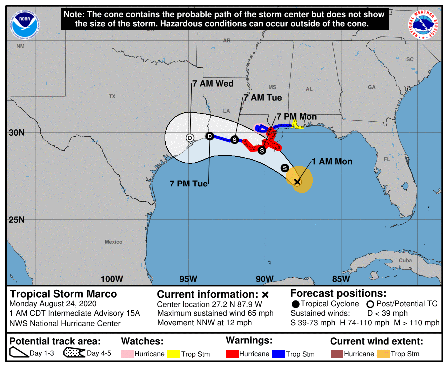
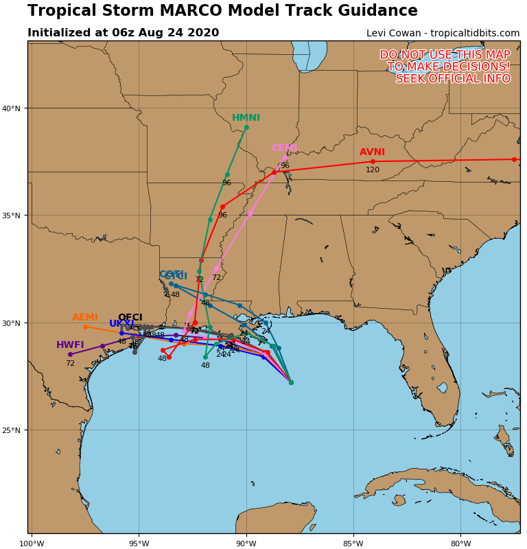
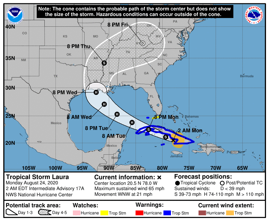

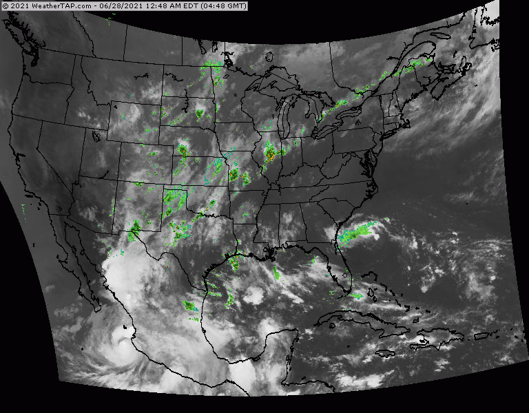
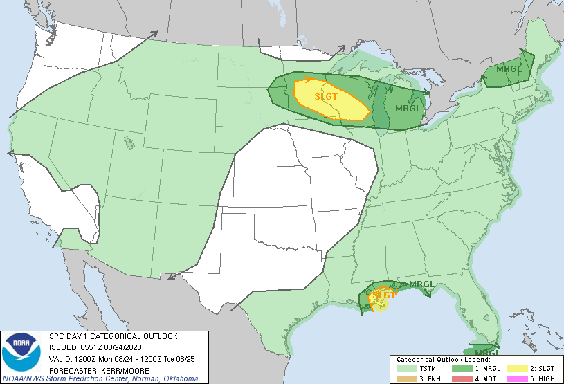
Above - hurricane center for Marco...then computer model tracks...followed by hurricane center for Laura...then computer model tracks. even after these systems make landfall...some of the tropical moisture could be taken into Ohio-Tennessee Valleys and then Mid Atlantic. Below- satellite + radar......animated maps - today;s severe weather threat - rainfall through Friday.


Your Robin Hood Radio Tri-State Forecast TODAY: SUN AND CLOUDS – 75-80 TONIGHT: CLEAR- 50-55 WED: MAINLY SUNNY AND WARM – MID 80S THURS:...

Your Robin Hood Radio Tri-State Forecast TODAY – SUNNY WITH A COLD WIND- MID 20S TONIGHT – ICY COLD AND CLEAR – 5 BELOW...
Your Robin Hood Radio Tri-State Forecast HEAT ADVISORY INTO WEDNESDAY HERE IS YOUR ROBIN HOOD RADIO TRI STATE FORECAST TODAY HAZY – HOT –...
