
TODAY: PARTLY CLOUDY- HUMID – CHANCE OF A THUNDERSTORM – 85-90
TNTE: PARTLY CLOUDY- MID 60S
THURS: CLOUDY, HUMID, SHOWERS AND THUNDERSTORMS – LOWER 80S
FRI: CLOUDY- HUMID – SHOWERS – LOWER 80S
SAT: CLOUDS AND SUN – LOWER 80S
WEATHER TRIVIA:1936 – HOTTEST EVER IN TEXAS: SEYMOUR HITS 120F.

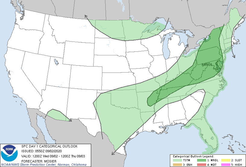
Satellite + radar above shows areas of showers and thunderstorms in patches across The Nation. Pattern will continue but drier air will press down across New England so they are in for a break. Below - animated maps through Thursday - today's severe weather threat - and rainfall forecast through Sunday.


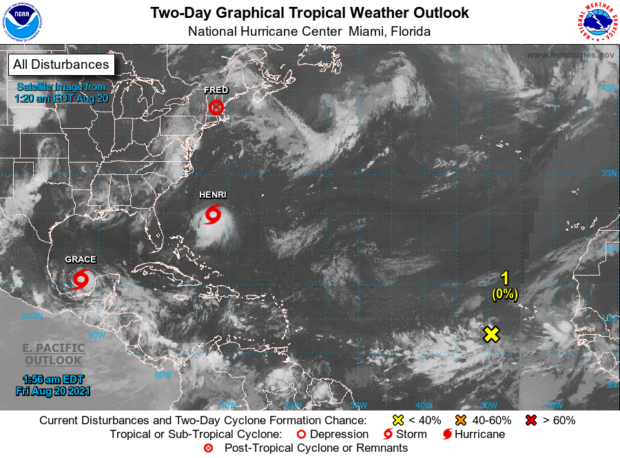
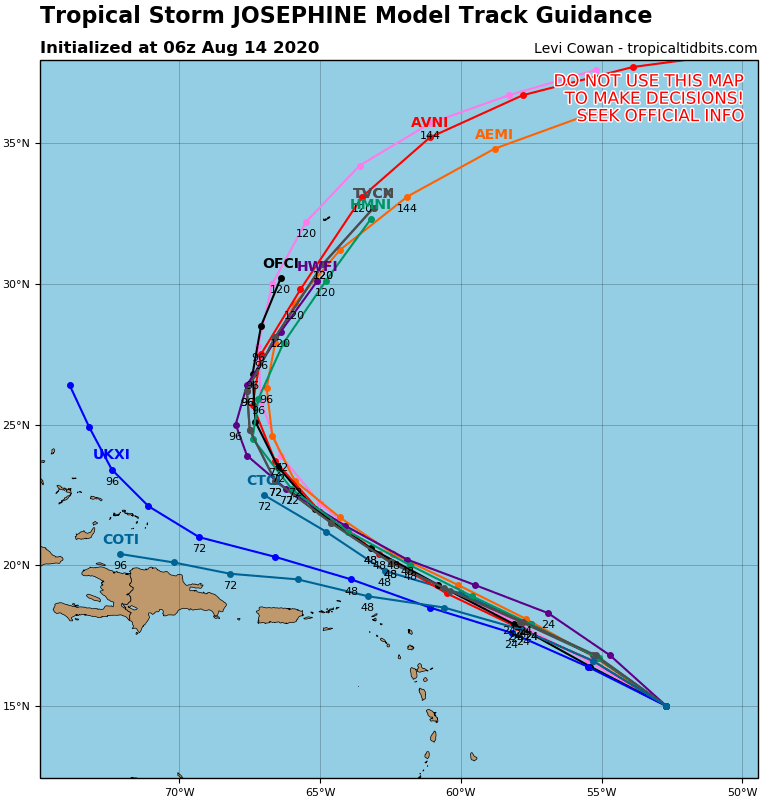
Below - tropical Atlantic - showing tropical depression 11 - 35 mph winds - should become tropical storm Josephine......plus hurricane center track - then tracks by models

Below - snapshot weather for Thursday.....be safe.


YOUR FORECAST: TDY: PARTLY SUNNY – LOWER 70S TNTE: CLOUDY- SOME SHOWERS – 50-55 WED: AN EARLY SHOWER OTHERWISE PARTLY CLOUDY – MID 60S...

Your Robin Hood Radio Tri-State Forecast TODAY – SUNNY WITH A COLD WIND- MID 20S TONIGHT – ICY COLD AND CLEAR – 5 BELOW...

Your Robin Hood Radio Tri-State Forecast TODAY – PARTLY SUNNY – MID 80S TONIGHT – PARTLY CLOUDY- LOWER 60S FRIDAY – SUNNY TO PARTLY...