
YOUR FORECAST:
TDY: MOSTLY CLOUDY- SOME RAIN - TURNING COOLER..LOW 70S THEN FALLING BACK TO 60S INTO 50S.
TNTE: CLEAR AND NIPPY – 45-50
FRI: SUNNY TO PARTLY CLOUDY – LOWER 70S
SAT: CLOUDY-LATE SHOWERS – MID 70S
SUN: PARTLY SUNNY..WARM AND MORE HUMID – MID 80S
WEATHER TRIVIA:
1960 – HURRICANE DONNA CROSSES CENTRAL LONG ISLAND AND INTO NEW ENGLAND.

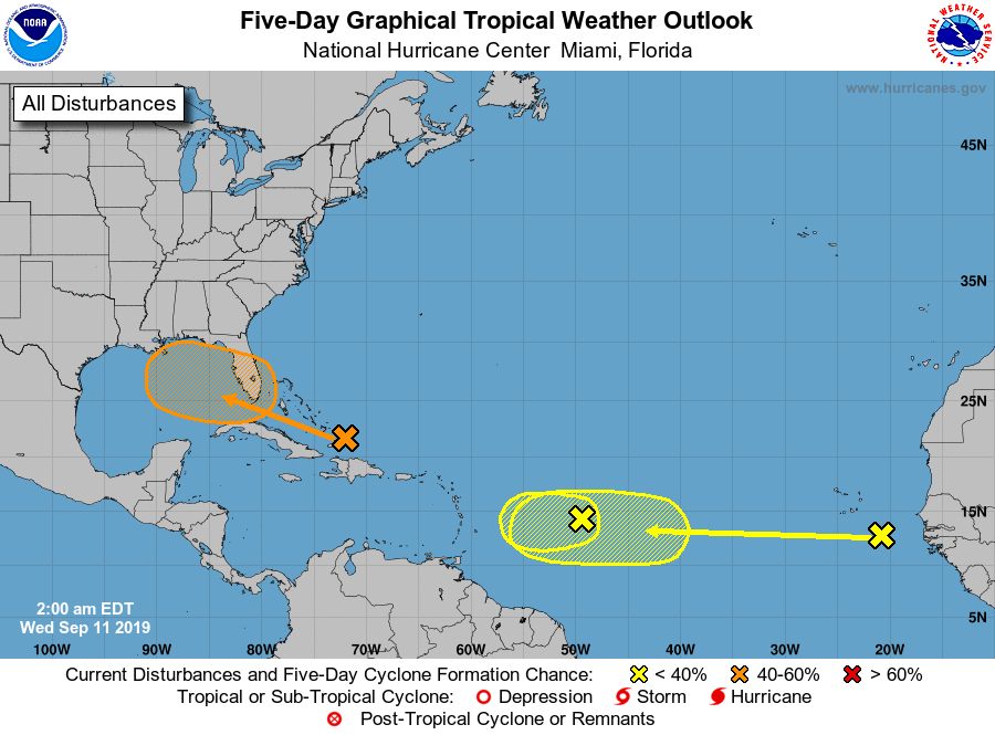
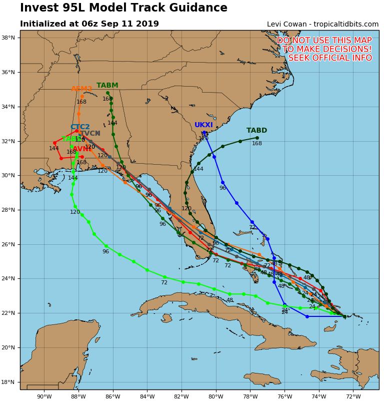
Satellite + radar shows strong storms in Upper Midwest....Northeast. Eastern Bahamas has a disturbance that could form into a tropical cyclone. Below - Atlantic hurricane map & track of Bahamas low.
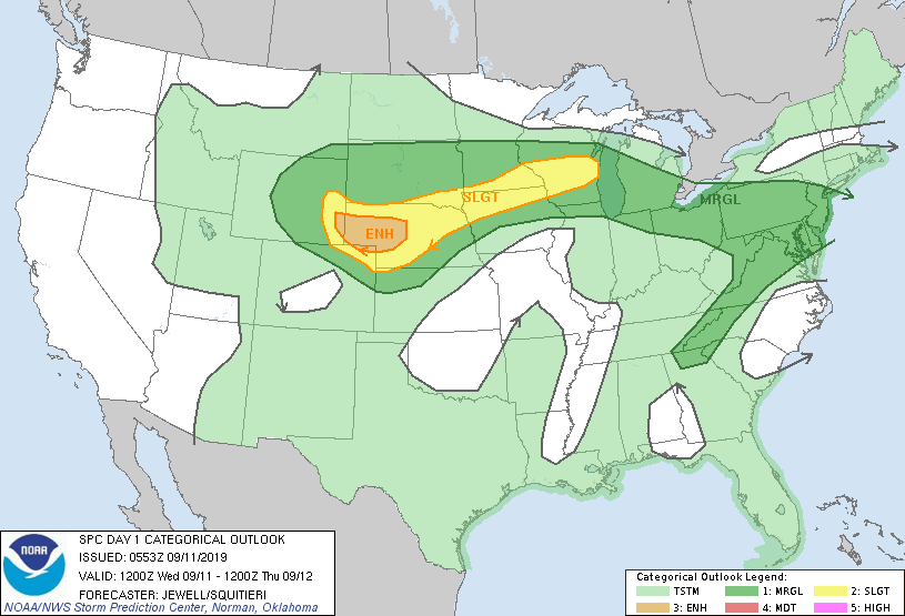
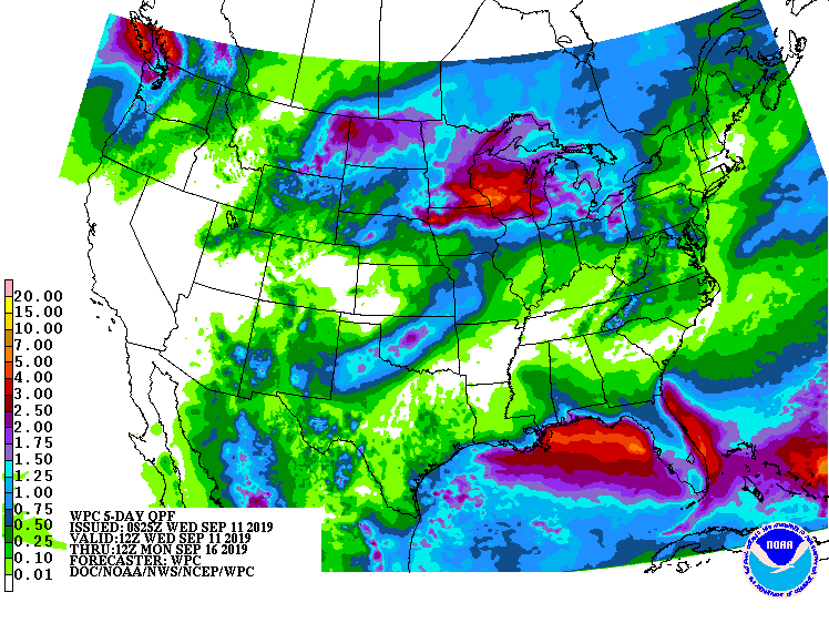
Below...today's risk of severe weather - dark green ..yellow - tan...followed by animated maps...and rainfall thru Sunday.
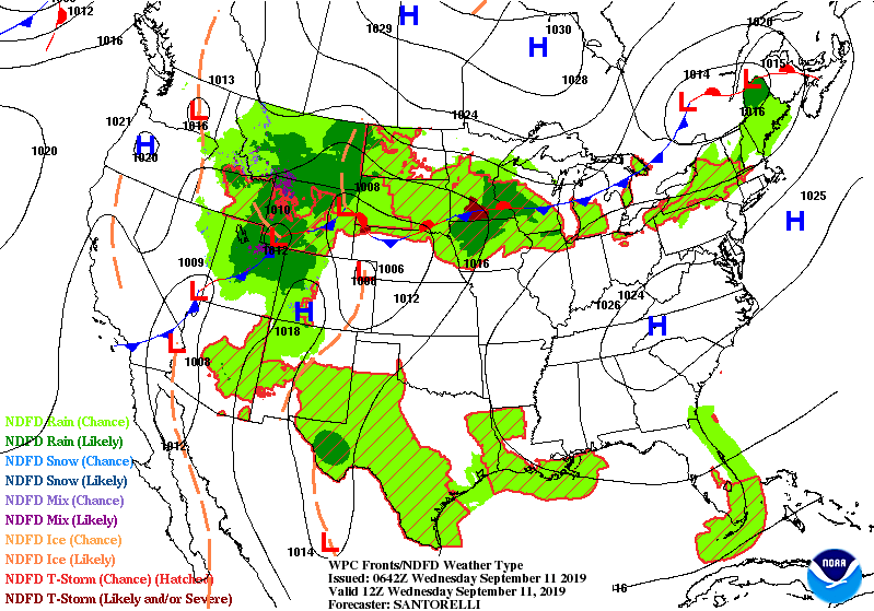
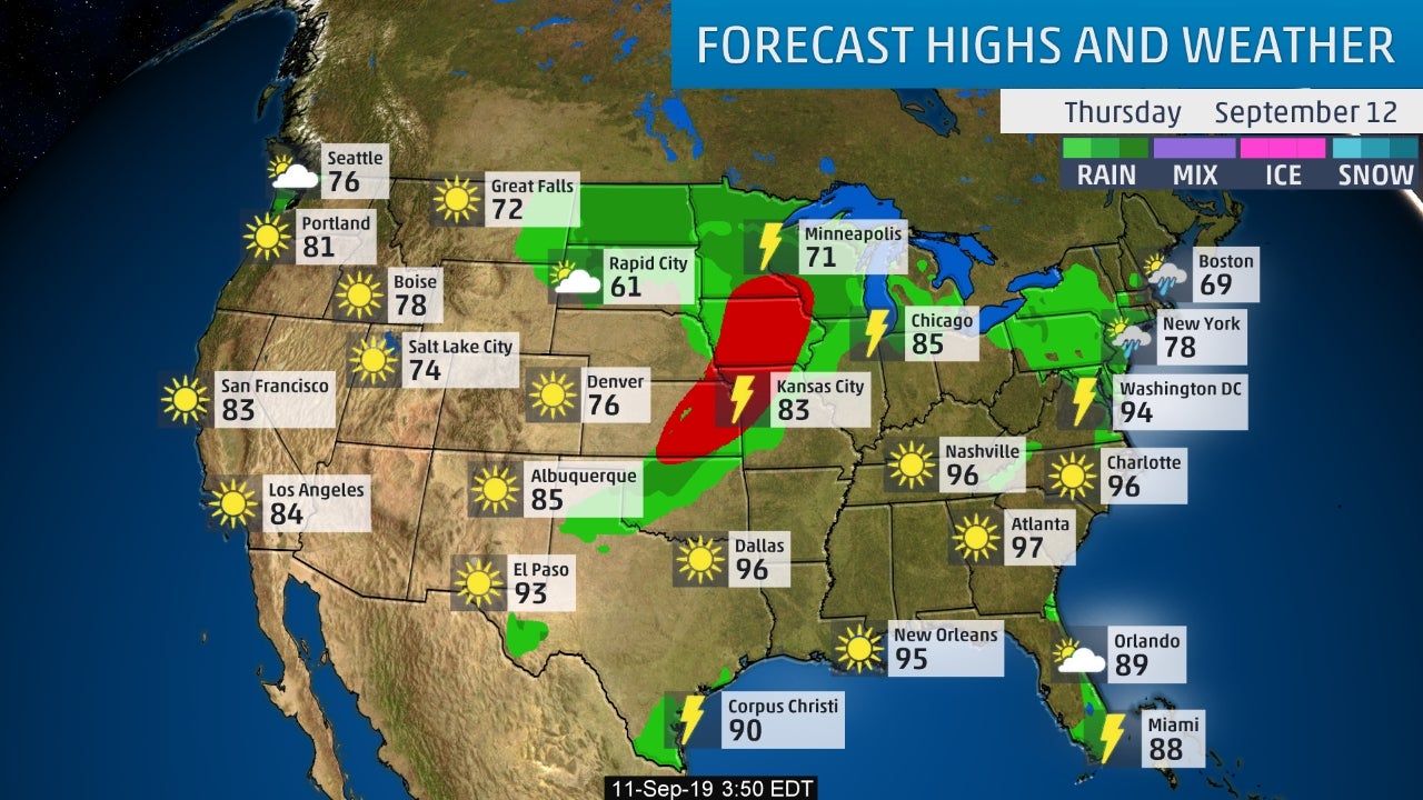
Below - snapshot weather for Thursday. Be safe.

Your Robin Hood Radio Tri-State Forecast TODAY– SUN AND CLOUDS – 55-60 TONIGHT – MOSTLY CLOUDY – LOWS 30 SATURDAY – PERIODS OF RAIN...

YOUR FORECAST: TDY: CLOUDY…SOME SUN – 50-55 TNTE: CLOUDY- 30-35 WED: PERIODS OF RAIN – 40-45 THURS: SHOWERS END – MID 50S FRI: CLOUDY-...

Your Robin Hood Radio Tri-State Forecast TODAY: PARTLY CLOUDY- 60 TONIGHT: PARTLY CLOUDY- LOWER 40S WED: CLOUDS AND SOME SUN – 65-70 THURS: CLOUDY-...