YOUR FORECAST:
TDY: PARTLY SUNNY – MORE HUMID – CHANCE OF A SHOWER – MID 80S
TNTE: CLOUDY- SHOWERS – THUNDERSTORMS - 70
THUR: HAZY – HUMID – SCATTERED SHOWERS & THUNDERSTORMS – 75-80
FRI: SUNNY TO PARTLY CLOUDY – MID 70S
SAT: CLOUDY- SHOWERS - 80
WEATHER TRIVIA:2001 – 9-11 ATTACKS ON N.Y.C. UNDER CLEAR SKIES WITH UNLIMITED VISIBILITY.

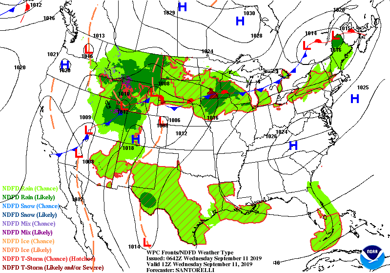
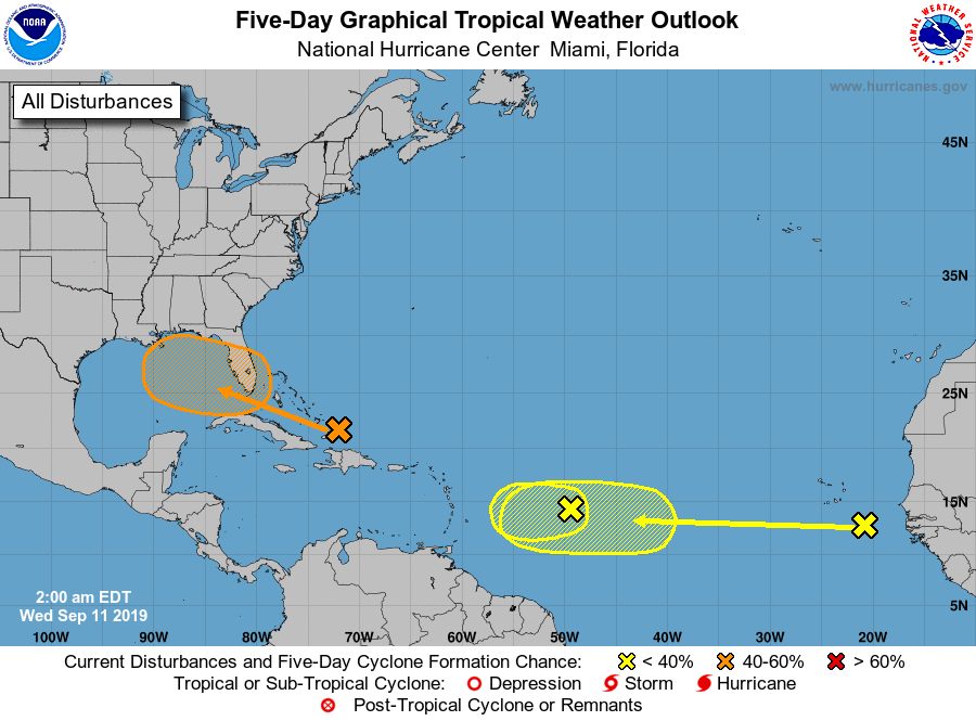
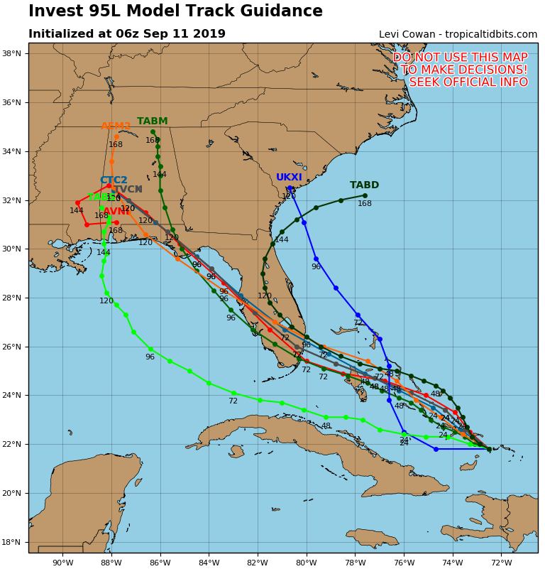
Satellite + radar shows strong storms in Upper Midwest....Northeast. Eastern Bahamas has a disturbance that could form into a tropical cyclone. Below - Atlantic hurricane map & track of Bahamas low.
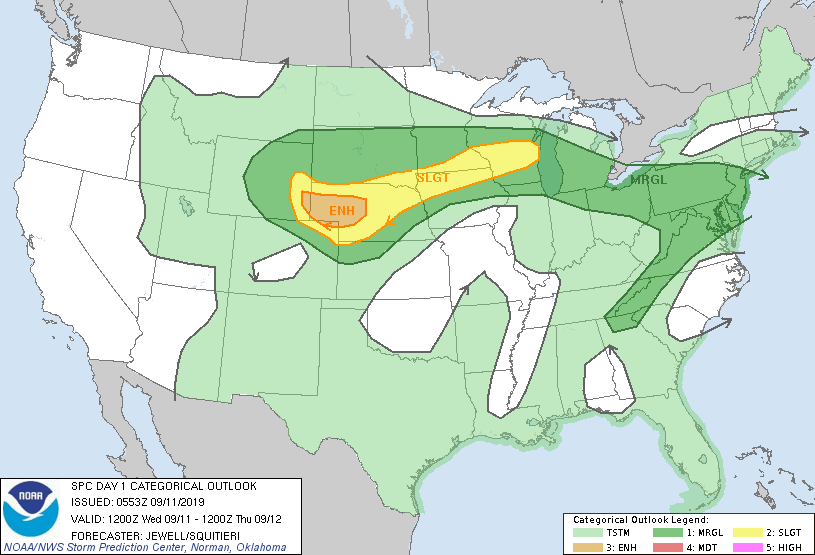
Below...today's risk of severe weather - dark green ..yellow - tan...followed by animated maps...and rainfall thru Sunday.
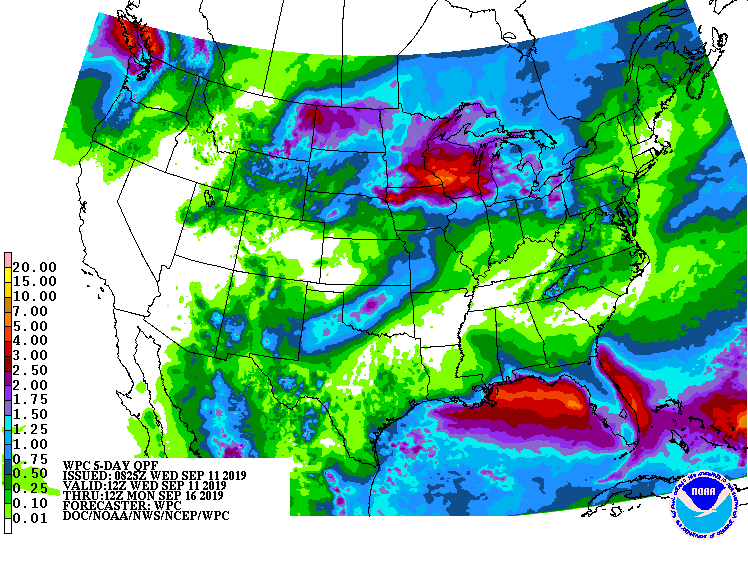
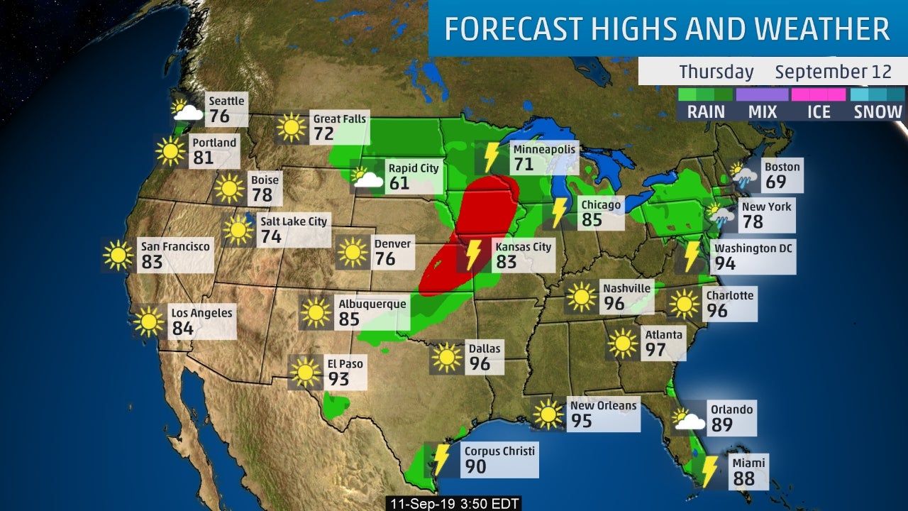
Below - snapshot weather for Thursday. Be safe.

TODAY – PARTLY CLOUDY- LOWER 70S TONIGHT – CLOUDY- A SHOWER – MID 50S THURSDAY – CLOUDY- LATE SHOWERS, A THUNDERSTORM -LOWER 70S FRIDAY...

Your Robin Hood Radio Tri-State Forecast TODAY – PARTLY CLOUDY- 40-45 TONIGHT – CLOUDY- LOWER 30S FRIDAY – SUN AND CLOUDS, WINDY- MID 30S...

...WIND ADVISORY IN EFFECT UNTIL 8 PM EDT THIS EVENING......FLOOD WATCH IN EFFECT THROUGH FRIDAY MORNING... This Hazardous Weather Outlook is for northwestern Connecticut,western...