

YOUR FORECAST:
TDY: SUNNY – BREEZY- LOWER 50S
TNTE: TURNING CLOUDY- CHANCE OF A WINTRY MIX TOWARD MORNING. 30
THURS: CLOUDY- ANY WINTRY MIX CHANGES TO RAIN - 40
FRI: WINDY- WARM – SHOWERS – 65-70
SAT: PARTLY SUNNY WITH A COLD WIND – MID 40S
WEATHER TRIVIA:1925- DEADLY TORNADO IN MIDWEST: 626 KILLED, 2000 INJURED.
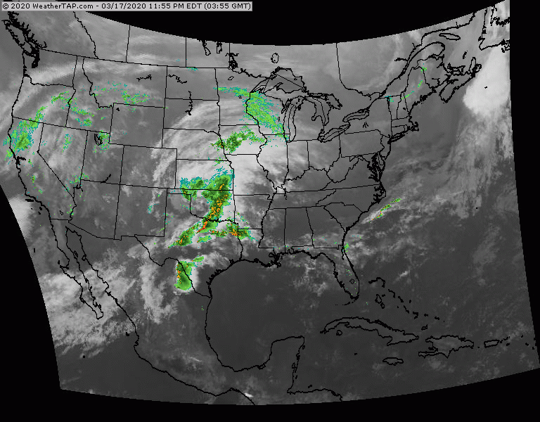
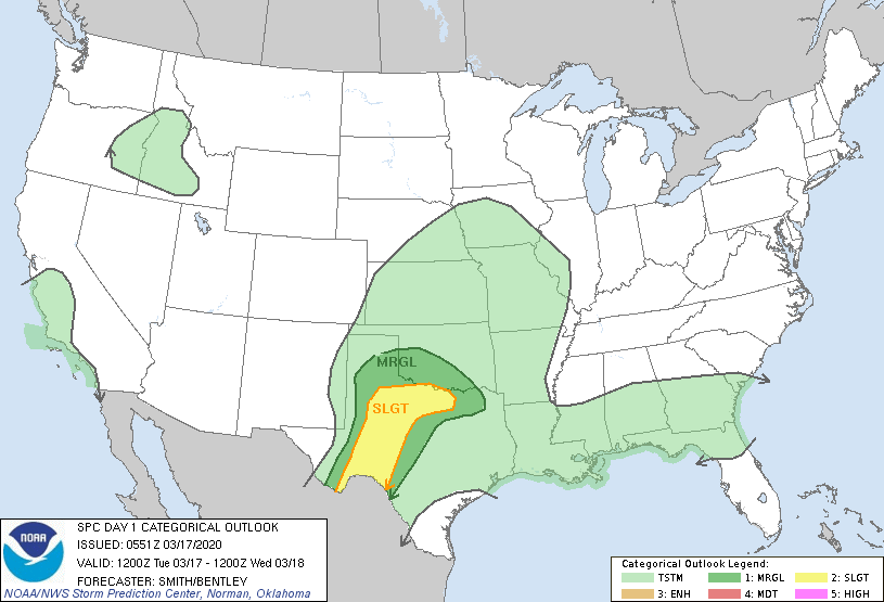
Satellite + radar above shows next front moving into Midwest and SouthernPlains. That system will affect the East Thursday into Friday with warmer air. Behind it...noticeably colder for weekend....and Spring arrives Thursday night. (11:50pm - east) Below- today's threat of severe weather in dark green and yellow
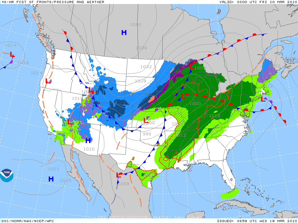
Below - animated maps through Thursday....snowfall and rainfall projections through Sunday.


Below- snapshot weather for Thursday. Once again...be safe and the only way to do that is by staying home so we can stop this VIRUS.

Your Robin Hood Radio Tri-State Forecast YOUR FORECAST:TDY – SUNNY- MID 70S TNTE – BECOMING CLOUDY – 60 TUES – PARTLY CLOUDY- MAYBE A...
...HEAT ADVISORY REMAINS IN EFFECT FROM NOON TODAY TO 9 PM EDT THIS EVENING... ...HEAT ADVISORY REMAINS IN EFFECT FROM NOON TO 9 PM...

Your Robin Hood Radio Tri-State Forecast TODAY– MOSTLY SUNNY AND BREEZY – 60 TONIGHT – CLOUDY- 40 TUESDAY – VARIABLY CLOUDY- LATE SHOWERS –...