

YOUR FORECAST:TDY: SUNNY- BREEZY – LOWER 60S
TNTE: CLEAR- COLD – MID 30S
THURS: SUN MIXING WITH CLOUDS – MID 60S
FRI: HAZY-BREEZY-WARM – SHOWERS AND A THUNDERSTORM – MID 70S
SAT: PARTLY CLOUDY- 70-75
WEATHER TRIVIA:1930 – ONLY AUTHENTIC DEATH CAUSED BY HAIL WHEN A MAN WAS CAUGHT IN AN OPEN FIELD IN LUBBOCK, TEXAS.
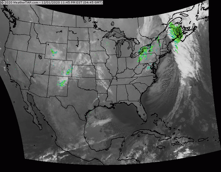
Satellite + radar above shows wet weather Tennessee Valley head east. Showers and storms from Dakotas to Rockies will land on the East Coast Friday....along with much warmer weather. Below - severe weather threat for today....dark green...yellow and brown.

Below - animated maps....rainfall through Sunday....tropical outlook over next 5 days which shows possibility of the first tropical system north of the Bahamas.


Lastly....snapshot weather for Thursday.
Stick to the rules...BE SAFE AT ALL TIMES....this is far from OVER !!


Monday: Mostly sunny, with a high near 72. Light north wind. Monday Night: Partly cloudy, with a low around 51. Calm wind. Tuesday: Sunny,...
ADVISORIES: WINTER STORM WATCH WED. A.M. THRU THURSDAY A.M. WEATHERCAST: A SKINNY RIDGE OF HIGH PRESSURE WILL GIVE US FAIR, SEASONABLY CHILLY WEATHER TODAY...
Your Robin Hood Radio Tri-State Forecast YOUR FORECAST: TDY: CLOUDY – SCATTERED SHOWERS – MID 70S TNTE: PERIODS OF RAIN – MID 60S SAT:...